SAM IS ....
Drones help churches from on high

Faced with huge bills to repair their crumbling spires, leaky roofs and weathered gargoyles, the country’s churches and cathedrals have had to seek help from on high. Not from God, but from drones.

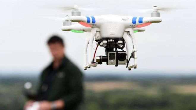
Britain’s largest insurer of church buildings has started deploying the aircraft to perform aerial surveys, using a bird’s-eye view to assess the extent of damage and deterioration to features that are too lofty to be safely reached by ladder or even abseiling surveyors.

The cost of repairing and maintaining a 900-year-old cathedral can spiral into the millions of pounds but it can also be expensive and dangerous to carry out surveys as inspectors need access to spires, towers and turrets hundreds of feet above ground.

The insurance group Ecclesiastical has brought in drones as part of a trial to assess the condition of the churches and cathedrals it insures.

The group has used the technology on two Church of England buildings and a school and will extend its trial to other sites. A spokesman said: “So far the technology has revealed damaged and loose high-level slates, tiles and stonework and missing pointing.”

The oldest parts of Worcester Cathedral date back almost a thousand years to 1084, with other parts added over subsequent centuries. It costs £7,500 per day to maintain the cathedral, which has spent more than £800,000 on repairs to internal elements such as the medieval ceiling in its library and its Great West Window in recent years. Work to its 62m tower has had to wait, however, as it has proved too expensive and difficult to carry out a full survey.

The internal stonework of the tower dates back to the 14th century, but it was re-faced in the 19th century. The future King Charles II is said to have watched the Battle of Worcester from the top of the tower during the civil war in 1651.

“We were conscious that parts of the tower needed to be inspected but the costs and logistical challenges of doing this meant we had not been able to do so,” Val Floy, the cathedral’s chief operating officer, said. “The imagery captured by the drone will enable us to do an initial assessment so we can prioritise future work and inspections.”

St Hilda’s, a church in Halifax, was built in 1911. It is aiming to raise at least £15,000 owing to the “urgent need for extensive work to be carried out on the fabric of our roof”, according to the parochial church council.

The Rev Caroline Greenwood, the church’s vicar, said: “We’ve known about issues with the church’s guttering for some time but haven’t been able to get up to the roof to inspect them properly.

“Now we have really clear pictures of the problem and we can submit the photos as part of our grant application and hopefully that will strengthen our case.”

Mark Matthews, risk management director at Ecclesiastical, said that ancient buildings presented “unique” challenges when it came to maintenance. They often face particular difficulties in trying to access precarious spires and pinnacles that reach up to the heavens.

“The use of drone technology provides access to high-quality imagery and very accurate data, which can be difficult to obtain via traditional surveying methods,” Mr Matthews said.

The insurance group also used a drone to assess a school in southern England and said: “They received a shock when the drone revealed a number of footballs, rugby balls and tennis balls sitting on the roof of its new sports hall blocking the gutters.”

A spokesman said the technology could help churches to obtain more accurate information when deciding how best to protect and preserve their buildings. He added: “The data gathered from the drones will also enable Ecclesiastical to calculate reinstatement or restoration values with more certainty reducing the risk of underinsurance for its customers.”

The National Churches Trust has used Heritage Lottery Fund money to explore the use of “unmanned aerial vehicles” to survey churches, using drones to produce 3D computer images of buildings.

One church in north Yorkshire had to cut short a drone survey of damage caused by pigeons in 2015, however, when they were warned that the operator had not received permission from the Civil Aviation Authority.

The battle to preserve ancient churches has lead to an arms race, amid reports that gangs of organised criminals have used drones to identify which churches have lead roofs ripe for theft.

Winged messengers
Although they can be used by troublemakers to bring airports to a standstill, or by criminals to survey homes that they want to burgle, drones have many positive uses:

● Police forces have begun using drones to search for missing people, photograph crime scenes, track down suspects and monitor crowds. The approach is particularly useful in rural areas; the police in Suffolk use the devices to spot illegal hare coursing with dogs.

● The online retailer Amazon made its first delivery by drone in December 2016 and plans to introduce Prime Air, an airborne version of its rapid delivery service.

● Last year a baby on the Pacific island of Vanuatu became the first person to receive a vaccine delivered by a commercial drone, which was flown by Unicef over 25 miles of rugged terrain that would take hours to cross by other means.

● Drones have been used to gather the information to create 3D computer models of bridges for surveys to detect structural flaws.

● Ecologists are increasingly using drones for unusual tasks, including counting herds from the sky and collecting snot from a whale at sea.

From The Times

12/2/2019

Religious Affairs Correspondent

SAM IS ....
Smart City Drones: pollution monitoring

Over the last year, there have been an increasing number of stories, reports, and university studies around drones being used to measure pollution, from particles to noise to light.  The effects of pollution on the world’s population can’t be disputed.  In Europe, the air you breathe could be the death of you. In fact, it could be killing as many as 400,000 people a year prematurely according to the World Health Organisation (WHO). As well as bringing about the early demise of almost half a million people, there are associated health costs that run into hundreds of billions of euros.

This article combines much of what is freely available on the internet, but that when put together shows an increasingly negative picture of our planet. However, drones can help.

In Bangkok, Thailand, a fleet of drones was deployed on 22nd January 2019 to spray water and non-hazardous chemicals into the air in an attempt to reduce pollution. A test run of the drones earlier in the week in a small park showed that the drones reduced dust particles in the air by about 10 micrograms per cubic meter. While the drones were successful on a small scale, more testing needs to be done to see if the drones could cover a larger area and clear pollution out of the entire city.

In Seoul, South Korea last summer the Ministry of Enviornment tasked drones with  inspecting factory emissions in the capital’s greater metropolitan area. It’s the latest in a series of tech solutions aimed at solving Seoul’s dust dilemma – which has become so serious that earlier this year the city government declared it an emergency.

In Shanghai, China, a domestically-produced drone aircraft designed to disperse smog was tested on Saturday, official media reported, in an important step for the country’s domestic aviation industry. Almost all Chinese cities monitored for pollution last year failed to meet state standards. The environment has emerged as one of Beijing’s key priorities amid growing public disquiet about urban smog, dwindling and polluted water supplies and the widespread industrial contamination of farmland.

With more than 1,400 islands, maritime and air transports are common in Greece. Tests carried out in Santorini demonstrated that concentrations of ultra-fine particles were up to 100 times higher near the ports. But in recent years, the situation has been improved thanks to better fuels and replacement of polluting old technology.  The evaluation of air quality and pollution has been traditionally conducted by ground based monitoring. Complexity of the terrain and physical barriers usually complicate data collection, augmenting costs and decreasing efficiency and performance. The drones, used in a study at the Industrial, Energy and Environmental Systems Laboratory of the Technical University of Crete,  were able to capture air pollutant emissions and to create a 3D visualization tool of a determined area. The sensors were able to measure:

  • air temperature,
  • atmospheric pressure,
  • humidity,
  • carbon monoxide (CO),
  • carbon dioxide (CO2),
  • sulfur dioxide (SO2),
  • ozone (O3),
  • nitrogen dioxide (NO2),
  • and ammonia (NH3).

Drones equipped with compact sensors can provide data at nearly any point in a three-dimensional axis. This interesting characteristic favours the reduction of sensor nodes used in every smart cities or smart environment project, diminishing the total cost of the solution. Additionally, permits the user to obtain local data for production monitoring, problem detection and local climate control

Hong Kong authorities are set to ramp up the fight against air pollution from ships by flying drones to monitor emissions. Hong Kong environmental inspectors will take to the skies to police the city’s waters with drones to help enforce a new law requiring ships to burn cleaner marine fuels.  Dr Zhi Ning of the university’s environment and sustainability division, who led the one-year research project – funded by the Environmental Protection Department at a cost of HK$1.1 million (US$140,193) – said the idea was to provide support to what would otherwise be time- and labour-intensive enforcement work. In Norway, the Norwegian Maritime Authority plans to use drones equipped with sensors to measure sulphur content from ships’ exhaust systems in its inspection work. $1.7million was invested in the project.

In the skies above Katowice, Poland, in the heart of country’s coal industry, Polish officials are deploying the latest weapon against air pollution: drones that inspect the city’s chimneys.  As soon as one of the unmanned aerial vehicles spots suspicious smoke rising from a rooftop, a second one follows up to “sniff” for pollutants with its chemical sensors. Ground-based operators then send police officers to knock on the door of the offending home to see if they are burning poor quality coal, plastic bottles or some other substance. “Most people decide to pay a fine immediately rather than go to court,” Katowice police spokesman Jacek Pytel told AFP, adding that fines can be up to 120 euros ($148). The fight against air pollution is crucial, with a World Health Organisation’s report showing that 36 of the most polluted places in Europe are in Poland.

In Spain, a drone company is taking to the skies to combat a rising global problem – light pollution. They are developing a method to map areas at night to determine the optimal process for street-light deployment in major cities – a process that can help mitigate light pollution.

Drones are specially considered for measuring and monitoring air pollution because of their mobility and convenient flying-movement. UAVs can monitor noise, traffic, light, wind, temperature, humidity, air quality and many other parameters.  We will become increasingly familiar with such drones in the fight to save our planet from the effects of the industrial age.

Elena Major

11/2/2019

SAM IS ....
Drone Captures Thousands of Years of Archaeology on Remote Scottish Islands

Drone survey of Canna and Sanday Islands collected 420 million data points, creating what may be the most detailed 3-D map of islands yet


The Small Isles, a gorgeous archipelago in Scotland’s Inner Hebrides, are protected as part of a National Scenic Area. But it turns out the sparsely populated islands are also now a high-tech landmark. The islands of Canna and Sanday, which are only separated by a tidal channel, are now the most minutely mapped islands in the world reports the BBC, and the imaging has unlocked thousands of years of archaeology.

Last November, the conservation charity National Trust for Scotland, which administers the islands, hired the Glasgow-based mapping firm GeoGeo to conduct a detailed drone survey of the islands to precisely locate archaeological features. Over the course of five days, a state-of-the-art fixed wing drone flew a total of about 250 miles, collecting 4,000 ultra-high-resolution images and 420 million data points. The team then used a proprietary super computer to analyze the data, creating an incredibly detailed 3-D map of the connected islands. “This not only shows detailed topography and vegetation at a game-changing three centimeters [1.18 inch] resolution but, with over 420 million data points, is currently the world’s largest complete island dataset captured by drone,” Paul Georgie, founder and lead geospatial technologist for GeoGeo says in a press release.

The maps are already revealing the past history of the island, showing previously unseen remnants of “rig and furrow” agriculture dating back to the Bronze Age. The data reveals that at its peak in the 1800s, agriculture on the island could have supported up to 400 people.

“The detail is simply astounding – aerial surveys for archaeology have been around since the end of World War Two but this new technology takes everything into a completely new realm, being considerably more detailed, affordable and flexible,” Derek Aleaxander, head of archaeology at the National Trust for Scotland, says in the release.

Today, though a handful of people still live on the islands, agriculture has given way to a colony of about 20,000 seabirds, which the Trust worried might be disturbed by the drone. They also prepared for the drone to be attacked by the golden eagles and white-tailed sea eagles in the area. Though the pilots were ready with a barrel role in case of ambush, luckily there were no bird-drone incidents.

The data is now being used to update the archaeological inventory of the islands and to plan future digs in the area.

While the new 3-D map might be one of the more impressive feats of drone archaeology, it’s far from the only example, and will likely be eclipsed in the near future. In recent years, researchers have begun flying drones over cultural sites all over the world, getting perspectives and measurements they just can’t see by digging on their hands and knees. Michael Casey at the AP reports that thermal imaging cameras and other mapping tools can see feet underground and uncover things like buried structures or foundations that would have taken months of digging to reveal previously.

In 2016, drone imagery helped uncover an unknown massive monument in the ancient city of Petra in southern Jordan, and just last year, drone photographers found the remnants of 4,500-year-old henges, or monumental circles, in agriculture fields in Ireland’s Boyne Valley and previously unseen geoglyphs near the Nazca Lines in Peru.

No doubt, drones have the potential to make other astounding discoveries.

SMITHSONIAN.COM
SAM IS ....
First test flights for National Beyond visual line of sight Experimentation Corridor

The first test flights to establish the principles for the National Beyond visual line of sight Experimentation Corridor (NBEC) have successfully taken place at Cranfield Airport.

NBEC is a collaboration between Cranfield University and Blue Bear Systems Research Ltd that aims to create an experimentation corridor that will enable drones and unmanned aircraft to fly in the same airspace as manned aircraft.

Blue Bear executed three-kilometre Extended Visual Line of Sight (EVLOS) race track flights within the Cranfield Air Traffic Zone, utilising their Blackstart Unmanned Aerial System (UAS) towards their facility in Oakley. Regulations currently require drones to operate within visual line of sight of the operator at all times. Under EVLOS conditions, observers are used to maintain the line of sight while providing situational awareness to the operator.

The NBEC partners believe the key to future drone operations is not segregation, but unification ensuring fair and equitable use of airspace for all. NBEC will provide a safe, managed environment for drone and unmanned aircraft experimentation which will work towards their integration into controlled and uncontrolled airspace.  The aim is to see the corridor eventually stretch across Bedfordshire from Blue Bear’s headquarters in Oakley to Cranfield University’s airport.

Ian Williams-Wynn, Managing Director of Blue Bear, said: “When fully operational, the NBEC will be operated with Blue Bear and Cranfield running their respective systems, and will create an environment that allows other companies to come and test their UTM (Unified Traffic Management) concepts in a safe, managed environment.

“These initial flights, enabled us to provide Cranfield Airport with reassurance from an operational safety perspective that the systems Blue Bear had developed and put in place are appropriate and compatible with Cranfield Airport operations.”

Professor Iain Gray, Director of Aerospace at Cranfield University, said: “The Government’s new aviation strategy green paper highlights the exciting potential of modernising the UK’s airspace. These initial flights, mark an important step in the realisation of NBEC, which will be a national asset that will support the journey to the creation of a Unified Traffic Management system.”

The Civil Aviation Authority (CAA) recently hosted the NBEC Team at its London headquarters, and provided the team with support and encouragement on their project and their staged risk, managed approach. Workup flights will be continuing at both ends of the NBEC Corridor throughout 2019.

During this first phase of testing, the Cranfield Air Traffic Zone was cleared of manned aircraft, to enable the project team to establish the principles for future integrated NBEC operations.

About Cranfield University

Cranfield is a specialist postgraduate university that is a global leader for education and transformational research in technology and management.

Posted: 6/2/2019 on Cranfield University website: PR-19-014

SAM IS ....
Drones: Law, Regulation, Standards & Enforcement in UK & Europe – Harmony or Fragmentation

On 11 Feb 19, the RAeS hosted a day workshop entitled It was well supported by some 50 delegates from across the industry, including a number of ARPAS-UK members.

Mike Gadd, (ex CAA) now of Altitude Angel, outlined the ICAO framework and the work being undertaken in the drone domain regarding a framework for mutual recognition based on the Standards & Recommended Practices (SARPS), within the Annexes to the Chicago Convention.  Notwithstanding, the scope only relates to IFR operations & still relies on state-to-state recognition and as with such international consensus seeking forums progress is slow.

Dr Hans Heerkens of XL Cargo Drones detailed potential benefits of unmanned cargo aircraft (ACO) and challenged the conventional practices suggesting that such systems may operate STOL from access roads in trading estates at night!

DCC Serena Kennedy who is the National Police Chiefs Council Lead on Criminal Misuse of Drones, outlined the police approach to countering the use of drones for criminal purposes.  While the ANO can and has been used for prosecutions, the courses of action available to the police to counter a potential live threat is not clear in law and this it is one of the thrusts of the Drone Bill to address this shortfall.  The audience expressed a concern that police would require thorough training if they are to be able to ascertain legitimate commercial operations from illegal activity and commercial operators have experienced wide variability in police response to drone operations across the country.  She advised she is working to inform and standardise the police response to reports of drone abuse from the general public.

Our own Standards Director, James Dunthorne gave a stand-out presentation on the new proposed laws in Europe/UK and their potential impact on Commercial Operators.

On the question of risk posed by drone operations, James talked to an interesting slide on accident rates.  The take-away for me, avoid flights in on-shore helicopters!

With regard to  Counter UAS (C-UAS) initiatives, Tim Quilter of Aveillant (Thales) advocated a layered approach utilising radar, elint & electro optics.  Andy Sage of NATS, an advocate of safe drone integration into UK airspace advised that “UTM” to him was about unified traffic management rather that drone specific.  They were open for business with regards to supporting operators OSCs for BVLOS. Good news is that the development of standards such as Asterix protocols for co-operative target recognition will assist commercial users in the longer term.

Another session centred on standard development BSI & EUROCAE.  Progress in these areas will provide the Regulator with, to use James’ metaphor, ingredients for the BVLOS cake!

The event concluded with a panel discussion which included Mike Gadd from Altitude Angel, Andrew Cage from NATS, and our Standards Director James Dunthorne. The panel discussion focused on BVLOS developments, operational safety cases, standards and UTM. Our Standards Director suggested that the current regulatory OSC framework was adequate for realising BVLOS capability and just requires someone with determination to put forward a suitable safety case and technology solution for it to be realised. However it was also noted that airspace rules will likely need to be modernised to realise the full benefits of BVLOS, and mandated conspicuity is going to be a major theme in this process for all airspace users, something which may face some push back from other parts of the aviation community. Based on current opinions at the event though, it seems like it won’t be long before BVLOS operations becomes routine, and the work being done on airspace modernisation in the drone industry action group (DIAG) which ARPAS sit on, and the work being done by Altitude Angel on UTM integration will help to realise this much sooner than some may think.

In conclusion, harmony or fragmentation?  Probably something in between!!

SAM IS ....
Drone plan to carry medicines in Highlands considered
DroneImage copyrightPA

The potential of using drones to deliver medical supplies to GP surgeries, hospitals and care homes is being investigated in the Highlands.

NHS Highland is working with Highlands and Islands Enterprise and the University of the Highlands and Islands on the project.

The health board said drones could potentially pick up and deliver items across its regions.

NHS Highlands area includes the Caithness, Skye and Argyll.

‘Picking up’

The health board said the project, which is based in Inverness, was still in the early stages.

A spokesman said: “They could be used to transport goods and supplies across the region, delivering and picking up items from sites including, but not limited to, GP surgeries, hospitals and care homes.”

He said a so-called prior information notice had been issued so that the partnership could have a look at what was currently available, both in terms of the market and the available technology.

In Malawi in Africa drones have been tested for use in supplying medicines along a Humanitarian Drone Testing Corridor.


Posted on BBC website 21/1/2019