SAM IS ....
Unmanned Aircraft Systems — Developments in North Wales

Jointly with Wrexham Glyndwr University, Faculty of Arts, Science and Technology Unmanned Aircraft Systems — Developments in North Wales

11 March 2020

Chester Branch

Lecture

This is a joint lecture held at an earlier time, and away from our usual venue.

Exciting developments in Unmanned Aircraft System technology are happening in North Wales.

This lecture is a series of short talks discussing the wide extent of UAS technology applications in the region and highlighting Glyndwr University’s participation and role in these developments. This series of short talks will feature: novel composite technologies, pseudo-satellite UAS research and development, electrical propulsion for high speed flight, 3D image capture and model generation and the International UAS Challenge student competition entry design  for 2020.

No entry fees will apply at this event.

Prior registration is not required.

Speaker Details

Lead lecturers: Martyn Jones & Rob Bolam, Wrexham, Glyndwr University Faculty of Arts, Science and Technology

Location

Chester Branch

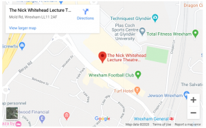
Nick Whitehead Theatre, Wrexham Glyndwr University, Mold Rd, Wrexham LL11 2AW

This is a Royal Aeronautical Society Event.


SAM IS ....
RAF Shawbury appeal to local drone flyers for cooperation in Low Flying Areas

RAF Shawbury posted the following on Facebook. ARPAS-UK agrees and further notes that the Low Flying Booking cell is 0800 515544 for reference.


Due to the recent flooding there has been a noticeable increase in drone activity in Shropshire and the surrounding areas. Our Shropshire neighbours are capturing images and filming the extent of the flooding from the air to record what is hopefully a once-in-a-generation event and understandably so. We have seen the results of such activity across all media channels. Drones are an amazing piece of technology that have an enormous potential for fun and we encourage their safe use but, did you know, drone operators have a legal responsibility to other aircraft and members of the public?

Shropshire and the borders of adjacent counties are part of the UK Military Low Flying Area (LFA) 9, a dedicated user area for military helicopter training. In this area there is significant low-level helicopter activity, often down to ground level and it continues despite the flooding. As a result, users of drones need to be especially vigilant if flying in this area and be prepared to land their drones at the first indication of any manned aircraft flying nearby.

Our Station Flight Safety Officer has created a leaflet on guidance to best practice when operating a drone within LFA 9, available here.  This should be read in conjunction with the Drone Code available here.

Drone operators are also encouraged to notify RAF Shawbury Operations if they are planning to fly their drone in LFA 9, so that our crews can be made aware. RAF Shawbury Operations can be contacted on 01939 250 351 Extension: 7221.

Your cooperation is really appreciated and we wish you happy flying!

26/2/2020


SAM IS ....
Drones to be an option instead of fireworks for 2021 NYE celebrations in Canberra
Following the cancellation of this year’s New Year’s Eve pyrotechnics performance, the ACT government will join others around the world looking towards environmentally safer options.  Fitted with LED lights, the displays usually include hundreds or even thousands of tiny drones flown in formation to create images. The reusable technology does not produce the same air and noise pollution as fireworks displays.

A government spokesperson said Events ACT will continue to explore alternate options to fireworks – including drones – and will provide advice to the Chief Minister and the Minister for Arts, Creative Industries and Cultural Events in due course.


“Off the back of the recent experience with our summer events, Events ACT is exploring options for alternatives to fireworks, however no decision has been made at this time regarding NYE 2020 celebrations,” the spokesperson said.


Events ACT was in the midst of a busy event season this week with the Enlighten Festival due to commence next Friday. The Canberra FM funded Skyfire fireworks event signalling the end of the festival on March 14 was scheduled to go ahead.


Sydney’s iconic display could also be a thing of the past with the City of Sydney Council also canvassing the idea of a drone show.


Shows using about 500 drones had been reported to cost as little as $75,000, while the decision to go ahead with Sydney’s recent fireworks display cost the council more than $6.5 million. Since the first drone show in 2012, there has been a rapid intake of the fireworks alternative worldwide.


Lady Gaga kicked off the NFL Superbowl half-time show with 300 drones creating the US flag behind her and a year later, 1218 lightweight drones opened the PyeongChang Winter Olympics.

Footage broadcast globally depicting a drone display welcoming 2020 in Shanghai was later revealed to have been recorded during a practice run on December 28.


By Alex Crowe for The Canberra Times

23rd Feb 2020

SAM IS ....
Dublin’s first fast food by drone service to begin within weeks
Europe’s first fast food delivery service by drone will start in south Dublin in a matter of weeks, according to Manna Aero founder, Bobby Healy.

Speaking today on Independent.ie’s technology podcast, The Big Tech Show, Mr Healy said that the public service will be launched in a south Dublin suburb with 30,000 people in March. He said that the three-minute service will deliver food from several chains.

“Camile Thai is a partner on the food side,” he said. “Next Tuesday, we will formally announce the name of a major online food player that everybody knows.”

He said that “major online food player’s” delivery service app will have a new drone symbol.“You’ll open the app and, in this case of Camile Thai, it will offer for the food to be picked up by drone. If you order by drone it will be delivered in less than three minutes.”

Earlier this month, Camile Thai chief executive Brody Sweeney told a conference in Cork that the Manna Aero drone delivery system would allow customers to pick a landing area around their home, such as a patio or driveway.

Mr Healy, the former chief technology officer of CarTrawler, said that the Irish Aviation Authority has been supportive of the initiative.

“We’re going to open it up to about 30,000 people to begin with,” he said. “What we expect to happen is that there’ll be too much demand and so we’ll have to restrict it in some way. But anyone who wants to see it can just come along and see it happening. It will be in a public place.”

Mr Healy recently said that he hopes to scale to 50,000 delivery drones for the Irish and UK markets.

“We want to literally transform marketplaces, economies, and communities all over the world in a way that not just reduces our carbon footprint, but saves lives and creates jobs while doing so.”

According to the company, the airborne logistics platform ‘in-a-box’ will provide online meal ordering platforms, restaurant chains and dark kitchens with a 3-minute delivery promise to their local communities for “a fraction” of the cost of road-based deliveries. Manna Aero uses “custom-designed aviation-grade drones” built in Europe and the US.

The drone fleet is operated directly from the restaurant or ‘dark kitchen’ premises and is accessible to food tech providers and online food platforms in a “channel-agnostic manner”, the company says. It recently received €4.7m in funding from Dynamo Ventures, a company that specialises in supply chain and logistics firms.

Adrian Weckler for The Independent.ie

Feb 21st 2020

SAM IS ....
SOARIZON by Thales announces strategic partnership with CG Labs

SOARIZON, the integrated drone operations technology provider has formed a strategic partnership with CG Labs, experts in the capture and processing of data.

Based in Milton Keynes, UK, CG Labs works across many different sectors including industrial, construction, agriculture and events specialising in visualization, modelling and measurement, where technology and data manipulation deliver a new standard in accuracy and efficiency.

The partnership will involve the two companies collaborating on strategic opportunities to provide data processing solutions, giving SOARIZON customers a quality end-to-end data acquisition and processing service.

The partnership will provide SOARIZON customers with pre-flight consultancy on the best methodologies for data acquisition, as well as first class post processing capability that far surpasses the current go-to systems that utilise cloud processing.

Services available to SOARIZON customers include: Thermal Condition Reporting, LiDAR manipulation, 2D orthomosaics, 3D models, Digital Elevation, Surface and Terrain Models. All hosted on an accessible, user-friendly platform.

Streamlining the end-to-end process of gathering data by unmanned air systems in this way can save businesses time and cost, whilst maintaining full oversight of all drone operations and ensuring that all output is fully secure, therefore, minimising exposure and risk in data quality control and assurance.

Michael Oliver, Head of SOARIZON said of the partnership: “We are delighted to be working with CG Labs to introduce new and exciting capabilities into our service ecosystem. This partnership will bring valuable data processing services to our customers, helping them to further streamline their end-to-end drone operations. Like SOARIZON, CG Labs has ambitious plans to innovate and continuously improve. This partnership will help us to unlock the true potential of data acquired by drones for business and organisations of all sizes.”

David Cummins, Executive Director of CG Labs said: “We jumped at the chance to partner with the SOARIZON team. We are excited to be able to share our global processing capabilities and innovation with SOARIZON customers. Our tools will allow them to transform data into more useful insights that can add significant value to their own clients. Furthermore, as a customer of SOARIZON ourselves, we have found that we are able to streamline our own drone mission workflow, increasing our efficiency, safety and accountability, meaning that we save time, effort and money.”

The two companies will now work together on offering joint services and testing the value of integrating this type of service into the core SOARIZON platform.

About SOARIZON by Thales:

SOARIZON empowers scaled UAS operations through its secure, compliant and efficient ecosystem. Combining best in class mapping capabilities, NOTAMs, airspace data, and full risk assessment tools, SOARIZON enables enterprises of all sizes to maintain a full view of all drone operations, from planning through to approval and delivery.

Find out more and sign up for free at SOARIZON.io

About CG Labs:

As a member of the CG Tech group, CG Labs focuses on helping traditional businesses unlock the many benefits associated with digitising their systems and services. Data captured for photogrammetry, or using laser scanners, thermal and hyper/multi-spectral sensors can be quickly transformed to provide the end customer with digital solutions that are easy to access and generate unique insights.

SAM IS ....
Scientists research bees for the benefit of drones

British scientists are hoping research into the way bees adapt to their surrounding can help with the new age of delivery drones.

According to a report from the Financial Times, in a presentation to the American Association for the Advancement of Science conference in Seattle on Sunday, Professor James Marshall of Sheffield University demonstrated how he and his team are reverse engineering bee brains to create the drone prototype.

He explained: “Bees are really consummate visual navigators. They can navigate a complex 3D environment with minimal learning very robustly, using only a million neurons in a cubic millimetre of brain. For us they’re at a sweet spot for brain size and intelligence.”

The FT explained how the project has a £4.8m grant from UK Research and Innovation.

It detailed that researchers are carrying out two types of experiment to “reverse engineer” bee brains — work out how honeybees and bumblebees can reliably navigate over several kilometres, learning the features that will enable them to return to their nest.

The first experiment tracks the movements of bees as they forage, by attaching tiny radar transponders to their back.

Analysing the flightpaths can provide clues to the neural processes that lie behind them.

Joe Woodgate of Queen Mary University of London, who leads this part of the project, said: “Before we can track a bee with radar, we need to attach a small electronic tag to her back, which is easier said than done.

“They’re very good at escaping from us and when we do succeed, we’re left holding an angry bee which isn’t always the safest place to be.”

The FT went on to report how the team still believes commercial application of the technology is at least five years away.

He concluded: “To have drones flying around a city, where if they fall out of the sky there’s a very high risk of someone being injured or killed, regulators will have to be confident that what you’re flying around is safe.

The full Financial Times article can be found here. 

From Commercial Drone Professional, Alex Douglas.

16th February 2020

SAM IS ....
Drone training for Cranfield Airport staff in anticipation of future integrated airspace

Staff and students at Cranfield University and its Airport have completed a remote pilot course for flying unmanned aerial vehicles (UAVs) as part of long-term planning for integrated airspace use by manned and unmanned aircraft.

The commercial UAV remote pilot course incorporated a ground school element for flight planning – covering principles of flight, rules and regulations of the air, using aviation charts, risk assessment and meteorology – and a flight assessment to check demonstration of basic pilot competence, including how to respond in an emergency and being able to operate safety features.

Rob Abbot, Director of Aviation Operations at Cranfield Airport, who completed the training with some of his team, said: “Integrating UAV operations with airport activities and manned aircraft operations is going to be key in the future as we look to unleash the potential of a modernised UK airspace. This training has given myself and my team a solid understanding of UAV operations and the issues around using unmanned aircraft.

“UAVs could potentially benefit manned aircraft operations in a number of ways, ranging from monitoring, maintenance and repair tasks to de-icing the wings of aircraft in cold weather conditions. At Cranfield, we are already looking at how we may be able to use them for runway and airfield perimeter inspections.”

The course was provided by Consortiq, who have permission from the Civil Aviation Authority (CAA) to provide approved UAV training, and was scheduled to help prepare students for the BAE UAV Swarm Challenge running again at Cranfield in March this year.

Students who complete the course will receive CAA-approved certificates for the ground school and flight assessment elements.

Alex Williamson, Experimental Research Fellow in UAV Operations in the Centre for Autonomous and Cyber-Physical Systems, Cranfield University, said: “Providing this kind of hands-on training is invaluable in giving staff and students an insight into the operational considerations of flying unmanned aircraft, together with a working appreciation of regulations affecting their use. This experience has further grown Cranfield’s competency in this area. It also ensures staff and students can maximise their research potential with respect to UAVs.”

Around 40 students from the Autonomous Vehicle Dynamics and Control MSc and Applied Artificial Intelligence MSc courses took the training along with Airport and academic staff.

Regulations currently require UAVs to be operated within visual line of sight of the remote pilot at all times. Through the ongoing creation of the National Beyond visual line of sight Experimentation Corridor (NBEC), Cranfield University is also working with partners Blue Bear Systems Research, Thales and Vodafone to provide a safe, managed environment for UAV experimentation, ultimately working towards their unsegregated operation with manned aircraft in both controlled and uncontrolled airspace.

Both Consortiq and Cranfield University are Members of ARPAS-UK. It’s great to see Members supporting each other like this.

Cranfield University Website

Consortiq Website

SAM IS ....
7 ways drones have been helping to combat the coronavirus

To date there have been over 1000 deaths attributed to the Coronavirus, which originated in Wu Han, China. When news of the virus, now renamed Covid 19 by the World Health Organisation, first emerged, the Chinese authorities were criticised for their poor handling of the situation and several senior health officials have been removed from their posts.

The virus is a respiratory based one, with the main signs of infection being fever (high temperature) and a cough as well as shortness of breath and breathing difficulties. People have been advised to wear face masks, sneeze and then bin the tissue, and wash hands frequently to keep the risk of infection as low as possible. They have further been advised to remain indoors with only one family member allowed out to shop for food and other necessities every other day. The virus is highly contagious and is spreading more rapidly than SARS. To date it has killed more people in 6 weeks than SARS did in 8 months.

So, what role have drones played?

  1. Drones as a monitoring tool. The Authorities have been using drones to ensure that the advice in place is followed and the spread of the coronavirus is limited as far as possible. Films of empty streets have been seen on every news channel.
  2. Drones with in-built speakers have been used in Wu Han and other cities to remind citizens to wear face masks and return indoors. The language in some articles talking about this has been quite negative using adjectives of the drones such as “sharp-tongued”, verbs such as “scolding” and “yelling”, while others portray it as an education programme. In some cases the advice is looped and non-specific while in other cases, the voice is that of a local official.
  3. Drones have been spraying areas and people with disinfectant. The autonomous precision spraying tool (the agricultural drone), can be a highly effective alternative to accurately release disinfectants over public places. Compared with traditional disinfection approaches conducted by hands or lorry, drones can be directed to spray where it is needed and cover a wider area, helping to improve public hygiene and reducing the risk of virus transmission through surface contact.
  4. Tethered drones have been used with lighting equipment at large construction sites such as Vulcan Mountain Hospital, the 33,900m2 hospital built in 10 days for coronavirus patients.
  5. Drones have been used to deliver critical medical supplies and patient samples. This has reduced transport time and freed up much needed land-based transport, while reducing the person to person contact.
  6. Drones with thermal imaging solutions have been used in the eastern Liaoning Province to detect heightened body temperatures of people when out on the streets. When combined with facial recognition tools, a common tool in China used for a variety of purposes from payment to workplace security, the results are impressive.
  7. Drones have been delivering food, face masks and disinfectant products to people, again reducing the need for person to person contact and limiting the spread of the virus.


Clearly, drones aren’t going to solve all the problems that the coronavirus poses; they are simply a tool – for good. However, all too often drones are spoken of negatively. Instead, let’s give them and the people and companies operating them, the credit for seeing the various ways they can be used for good when combating this highly contagious virus.


Elena Major, ARPAS-UK

12th February 2020

SAM IS ....
Drones used to assess koalas’ health

The Guardian newspaper has reported the use of drones to assess koalas’ health after the rampant forest fires in Australia.

This is a great use of the technology: thermal imaging is used to find the koalas in the first place, reducing time taken meaning more time to find more koalas.

Then by hovering close by and beaming images to those nearby to assess the koalas in situ, only the koalas who are in need of treatment will be removed from their natural habitat. A drone can reach the koala’s location quicker than getting a cherry picker in place meaning faster assessments.

To remove a koala from a tree involves the use of a cherry picker, which means someone will be working at height, leaning out from the cherry picker and be at risk of falling. The drone reduces the number of times this needs to happen, reducing risk, cost and leading to more effective use of the cherry pickers.

Ultimately the health of the koalas, both those that stay in the trees and those rescued, benefits from this use. They are assessed faster, treated appropriately faster and this in turn means that more koalas will be seen in less time, which can only benefit the species.


For more photographs on this story: follow the link.


Feb 12th 2020

SAM IS ....
Medical Drones Tested in Hamburg

Using a drone, for example, tissue samples can be quickly transported from clinic to clinic.

An unmanned drone for the urgent transport of medical tissue samples between two hospitals has been successfully tested in Hamburg. The drone completed six flights on Wednesday over the almost five kilometers long distance between the Bundeswehr Hospital in Wandsbek and the Marien Hospital in Hohenfelde. This was announced by the Medifly research project.

Drone faster than an ambulance

The knowledge gained from this should flow into a trial run over several months. Medifly wants to find out whether urgent tissue samples can be transported reliably and safely with a drone. Tissue samples are often taken during surgery and must still be examined during the operation. The operation is interrupted for so long. If the expert for the examination is not in the same clinic, the sample has so far been transported by ambulance. The biggest advantage of the drone: it is not stuck in a traffic jam and can therefore shorten the treatment time for patients on the operating table.

Medifly: First tissue transport by drone

Transport without traffic jams: For the first time, a 10kg drone has brought tissue samples from the Bundeswehr hospital to the Marienkrankenhaus, which is almost five kilometers away. The flight took 10 minutes.

The drone performs the tests at an altitude of around 75 meters. Six marshals secure the route of the drone, which theoretically, however, can also manage its way on its own. Medifly’s partners include Lufthansa Technik and the Hamburg Economic Authority.

Westhagemann: A lot of potential

“We have taken a big step today for the future use of drone systems,” said project manager Boris Wechsler. Senator for Economic Affairs Michael Westhagemann (independent) said that the technology of unmanned aerial vehicle systems offers the German economy a lot of potential and growth opportunities.

Hamburg Journal – 05.02.2020 7.30 p.m.