Construction, mapping and surveying
Drones in Action End User Stories: Site Security Management | Severn Trent Water & Dovecote Park – By integrating automated drone surveillance, security patrols became three times faster across a 13-acre site. Drones provided real-time monitoring with thermal cameras, reducing reliance on manual inspections, improving safety, and lowering operational costs and carbon footprint.
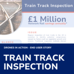
Drones in Action End User Stories: £1 million Network Rail savings annually* thanks to a new drone-based survey solution by Plowman Craven. The system operates 20 metres above the tracks with precision accuracy of +/- 5mm – meeting Network Rail’s requirements without disrupting services or putting workers at risk.
Drones in Action End User Stories: Using UAVs over traditional methods helps save around £5 million per year and helps to remove the need to put workers at risk.
ARPAS-UK has formally written to Checkatrade, the well-known online directory of trusted tradespeople, to express serious concerns regarding the way drone roof inspections are currently being priced and represented on their platform.
Drones are fast becoming an important asset in the construction and building industry. Using orthomosaic maps significant time and money can be saved on all sizes of projects. This article will explain what an orthomosaic map is, what it can be used for and the advantages of using drones to create orthomosaic maps for your…
Drones in Action End User Stories: Inspecting historical landmarks and churches is costly, time-consuming, and often risky due to height, fragile materials, and restricted access. Traditional methods like scaffolding can be disruptive and expensive, limiting funds available for repairs.
Drones in Action End User Stories: By using drone technology, independent volumetric datasets can be captured 50% faster than traditional quarry surveys.
Forth Valley College (FVC) has launched Scotland’s first ECITB Industrial Uncrewed Aircraft Systems (UAS) Operations: Foundation Training Course, marking a significant advancement in industrial drone training. This pioneering five-day program, hosted at FVC’s Falkirk Campus, is designed to enhance drone operation skills for industrial applications, including infrastructure inspections, site surveys, and data capture. Course…
Ofcom has announced a new initiative to make the 978 MHz spectrum available for drone safety devices in the UK. These devices, known as Universal Access Transceivers (UAT), help aircraft identify drones’ locations, ensuring safer integration into airspace. This change is essential for critical infrastructure tasks, such as inspecting power lines and wind turbines. The…
ARPAS-UK has today published its first Drone in Action Report. The purpose of this guide is to provide examples which demonstrate the range of benefits and financial savings that can be achieved by the safe adoption of Drones. Graham Brown, Chair of ARPAS-UK says, “When applied, drones are faster, cheaper, safer and greener than other…