SAM IS ....
EU Drone Strategy 2.0: “Innovative Aerial Services”, not drones.

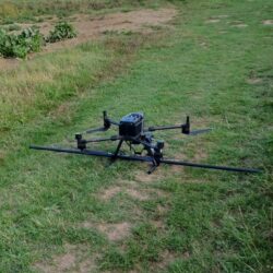
The European Commission issued its Drone Strategy 2.0 for a Smart and Sustainable Unmanned Aircraft Eco-System in Europe.

The report is available following this link. It gives a good idea of what is still needed to reach a thriving drone/RPAS/eVTOL market. Below are some take-aways.


Market size: €14.5 billion by 2030

“With the right framework in place, the drone services market in Europe could by 2030 reach
a value of €14.5 billion, with a compound annual growth rate of 12.3%, and create 145,000
jobs in the EU28″.

Technological synergies between civil, security and defense and presumably R&D funding synergies as well.

“The drone eco-system also includes the defence/military dimension for the purpose of
achieving technological synergies between civil, security and defence sectors.”

Renaming away from drone to Innovative Aerial Services (IAS) that embraces ”Aerial Operations“ (with drones) and Innovative Air Mobility“ (with eVTOL).

“On the civil side, the drone services market includes three segments which are interlinked: the new Innovative Aerial Services (IAS), including two segments: ”Aerial Operations“ (surveillance, inspection, mapping, imaging, …), and “Innovative Air Mobility“ (IAM), covering international, regional and Urban Air Mobility (UAM) and thirdly, ”U-space“. Although first IAM operations are expected to be conducted with manned eVTOL aircraft, such operations will likely be in the future performed on similar platforms but remotely piloted and then fully autonomous.”

List of 19 Flagship Actions:

  1. adopt amendments to the Standardised European Rules of the Air and the Air Traffic Management/Air Navigation Services Regulation to safely integrate drone and piloted eVTOL operations;
  2. promote coordinated research on integrated Communication, Navigation and Surveillance technologies;
  3. adopt new European standard scenarios for low to medium risk aerial operations;
  4. adopt rules for the ‘certified’ category of drone operations, addressing the initial and continued airworthiness of drones subject to certification; and the operational requirements applicable to manned VTOL-capable aircraft;
  5. adopt rules for the design and operations of vertiports under the scope of EASA Basic Regulation;
  6. develop balanced economic and financial requirements for licensing of drone operators.
  7. fund the creation of an online platform to support a sustainable IAM implementation by authorities, cities, industry and stakeholders;
  8. adopt training and competences requirements for remote pilots and pilots of VTOL aircraft.


    List of Actions to be implemented by the European Commission to strengthen the European drone civil, security and defence industry capabilities and synergies . The Commission intends to:
  9. continue to provide funding for R&I on drones and their integration into the airspace under the Horizon Europe programme and the European Defence Fund;
  10. set up a coordinated series of calls under the existing EU instruments and EIB loans to support a new flagship project on ‘drone technologies’;
  11. consider possible amendments to the existing financing/funding framework to ensure a consistent approach in support of dual-use research and innovation to improve synergies between civil and defence instruments;
  12. develop a Strategic Drone Technology Roadmap in order to identify priority areas to boost research and innovation, reduce existing strategic dependencies and avoid the emergence of new ones;
  13. coordinate with other relevant EU actors a common approach with the aim of providing sufficient radio frequencies spectrum for drone operations;
  14. set up an EU network on civil-defence drone testing centres to facilitate exchanges between civilian and defence sectors;
  15. encourage all relevant actors to further align certification requirements for civil and military applications towards those set by EASA while considering military specificities and existing military certification standards;
  16. adopt new standard scenarios for civil operations that could facilitate corresponding military use cases;
  17. adopt a counter-drone package;
  18. adopt an amendment to the aviation security rules aiming to ensure that aviation authorities and airports increase their resilience when faced with the risks posed by drones;
  19. define criteria for a voluntary “European Trusted Drone” label

ALS 2 Dec 2022

SAM IS ....
Protected: Members and Drone Community Survey Outcome

This content is password protected. To view it please enter your password below:

SAM IS ....
Funding: The Future Flight Skills Challenge. ARPAS-UK welcomes collaboration

Future Flight: Closing the Skills Gap

Competition Opens

Monday 21 November 2022

Competition Closes

Wednesday 1 February 2023 11:00am

Funding Type

Grant

Project Size

Your project’s total grant funding request must be no more than £50,000.

The Future Flight Challenge  for Innovate UK, part of UK Research and Innovation, will invest up to £500,000 in projects to close aviation industry skills gaps.

The aim of this competition is to create and deliver course content and materials that will support skills, talent and training across the future flight sector. The purpose of this is to build awareness of future flight emerging markets and fill key gaps in the UK’s workforce talent and training capabilities.

Projects can deliver one or more of these objectives:

  • schools’ engagement
  • apprenticeships and internships
  • upskilling and reskilling of existing workforce
  • technical courses and vocational training
  • undergraduate, postgraduate and continuing professional development (CPD)

This list is not intended to be exhaustive.

In applying to this competition, you are entering into a competitive process. This competition closes at 11am UK time on the deadline stated.

ARPAS-UK welcomes collaboration on projects for this Challenge

Please contact: [email protected]

Click here to access the Competition Briefing

Click here for more information

ARPAS-UK
Clogworks1-1

SAM IS ....
November 25 2022 Drone Related Jobs

Disclaimer: All jobs posted here are from LinkedIn and other job sites including member and non-member organizations.

Callen-Lenz are looking to recruit a UAS Pilot & Engineer.

Bristow Group are looking to recruit a UAS Pilot for their base in Lydd.

Jacobs are looking to recruit a Survey and Reality Capture Technician.

BT Group are looking to recruit a Product Researcher for Drone Solutions.

Royal Bam nv are recruiting for Head of Advancing Technologies & Innovation.

Newcastle University is looking to recruit Senior Geospatial Technician (Engineering Services).

Plowman Craven is seeking a junior UAV (drone) pilot to join an established and growing team.

Thales is looking to recruit a UAS Pilot/ Post Holder.

Murphy Geospatial is looking to recruit Senior Surveyor.

Wood is looking to recruit a Junior UAV Pilot.

Ernest Gordon Recruitment is looking to recruit a Systems Engineer (Drones/ Defence).

DRONAMICS is looking to recruit Director, Supply Chain & External Manufacturing.

SAM IS ....
UK’S FIRST HUB-CENTRIC NETWORK OPEN FOR BUSINESS

UK’S FIRST HUB-CENTRIC NETWORK OPEN FOR BUSINESS

Skyfarer have built the UK’s first functional and operational hub, set in the center of their own hub-centric network being utilized for the Medical Logistics UK Corridor.

WHAT IS A HUB-CENTRIC NETWORK?

Businesses and organisations subscribe to utilise the full capability of the Skyfarer hub and network. As a result, they can turn their use case into a regulated, authorised, and economically advantageous drone operation.

Having a shared service hub means that access to this technology and capability is far more cost-effective whilst not diminishing utilisation. Each hub is being developed to serve a 40km radius connecting each spoke. Whether that be to deliver a product or provide a surveillance solution, the Skyfarer hub contains a drone fleet that is specifically designed and optimised for each operation you are desiring to achieve. 

THE SKYFARER HUB

The heart of the Skyfarer Network of services is the hub, the “home of the drones”. This is a space where the drones are maintained, and operations are run for beyond visual line of sight (BVLOS) sorties.

The purpose of a hub-centric network is to centralize operations. This enables the Skyfarer team to run time-efficient and coherent flights that can be shared amongst end users. Meaning that services can be provided to customers cheaper, quicker and via means that are far more sustainable.

The Skyfarer hub contains a soundproof Operations room, a picking and packing station, an order management station, and a maintenance workshop. It also serves as the headquarters for the Skyfarer team.

The Skyfarer hub-centric network is being used for the first time as part of the ‘Medical Logistics UK Trial’ running from October to January. This trial links 2 hospitals managed by the University Hospitals Coventry and Warwickshire NHS Trust, to the Skyfarer hub and also enables a logistical connection between Coventry and Rugby local communities.

Skyfarer have chosen the West Midlands to set up its first hub due to its centralized location in the UK. This pertains to its history of innovation and technology development.

By 2030, Skyfarer sees a further 20 hubs spread out across the UK, to connect end users by the sky.

Email [email protected] to find out more about Skyfarer.

SAM IS ....
JBUAS  & Offshore Wind: SENSYS R4 HVDC Cable UXO Clearance Project

JBUAS  & Offshore Wind

SENSYS R4 HVDC Cable UXO Clearance Project

JBUAS supported a leading UXO company with equipment and training, to enable them to execute a 6km UXO clearance project over varied terrain, including undulating ground, fences and gates, hedges, and many different crop fields.

The Right Choice
The key contractor for the cable laying project was keen to see zero harm to the crops so damage could be avoided, along with any potential compensation payments. The airborne R4 magnetometer system was therefore selected as the system of choice. Cart or walked-based approaches were deemed too risky, and when the final economics were worked out, the use of the airborne system was a foregone conclusion.

Equipment Used
The airborne system comprised of:

– M300RTK drone (UAV)
– UgCS Pro (Survey Automation software)
– UgCS SkyHub 3 Onboard Computer
– UgCS True Terrain Following system (TTF v2)
– SENSYS MagDrone R4 Airborne Magnetometer

TTF, RTK, and R4
With a sample rate of 200Hz, the fluxgate sensors onboard the R4 enable fast speeds to be flown. The R4 also benefits from a sensor spaced every 50cm meaning its pass width is an impressive 2.5m. With RTK-corrected GPS data sent directly to the R4 from SkyHub, very precise flight lines (~1cm) are possible. Add to this the TTF system, which delivers the capability to perform low flying (below 1m if appropriate); the R4 can identify smaller targets in the near-surface.

To learn more about the project


SAM IS ....
November 18 2022 Drone Related Jobs

Disclaimer: All jobs posted here are from LinkedIn including member and non-member organizations.

Eiffage Kier Ferroval BAM are looking to recruit Drone Pilots to support their survey team.

Animal Dynamics Limted are looking to recruit a UAS Regulation Manager (UK).

ARPAS-UK Member TEKEVER are looking to recruit a Remote Pilot (UK).

Animal Dynamics Limited are looking to recruit a UAS Remote Pilot / Operations Assistant.

Volatus Aerospace are recruiting for an RPAS/UAS Instructor to join the team.

Dales Surveying Limited are looking to grow their team of UAV Pilots.

Flylogix are recruiting for a Test Pilot for Fixed Wing UAVs and an Electro-Mechanical Technician (UAVs).

HEROTECH8 are looking to recruit an Innovate Programme Manager.

ARPAS-UK member Aetha are recruiting for a Trainee Drone Pilot and a Junior Drone Technician. 

Airbus are looking to recruit flight crew for Zephyr.

Wingtra are looking to recruit a UK & Benelux Channel Sales & Business Development Manager.

A great opportunity with plenty of scope for growth.

SAM IS ....
CAP2404: Outcome of the consultation on a draft Airspace Modernisation Strategy 2022–2040

CAP2404: Outcome of the consultation on a draft Airspace Modernisation Strategy 2022–2040

Follow this link to access the outcome of the AMS 2022-2040 Consultation undertaken by the CAA


ARPAS-UK Community
CAA
SAM IS ....
ARPAS-UK Survey: Have your Say

How is the drone community doing? What should ARPAS-UK focus on in 2023? Take part in the ARPAS-UK Survey!

Dear fellow ARPAS-UK members, and members of the broader drone community,

We have collectively been through unusual times, and our environment will no doubt continue to evolve. Our leadership team has evolved, and we thought it was the right time to engage with you on how you are doing, and how ARPAS-UK can best support you and the community in the next 12-24 months.

This ARPAS-UK survey is anonymous. We want to hear your voice!

2 November 2022

SAM IS ....
The Use of Accurate and Complete UAS Aeronautical Information

A recent UK Airprox Board investigation and the CAA’s ongoing assessment of the mid-air collision(MAC) safety risk has shown that some service providers and UAS manufacturers are not using accurate and/or complete sources of Aeronautical Information. Using accurate and complete Aeronautical Information is a significant mitigation to the reduction of the MAC risk between UAS and manned aircraft.

It is hoped that you will agree that from both safety and business perspectives it makes sense to use the most up to date, accurate and complete Aeronautical Information in your services and products. This also prepares you for any additional future service and product requirements that may be developed in the UK. That is why that I would like to tell you where the official source of Aeronautical Information can be found, where to use it and to recommend where you should pay special attention.

Further details on best practices can be found in CAP779 (Chapter 1, Paragraph 1.35) which contains information for all organisations or individuals that process aeronautical information sourced from UK Aeronautical Information Products to help ensure that data maintains its integrity, is timely, complete and in a form suitable for users.

The official source of Aeronautical Information in the UK
The official source to obtain accurate and complete Aeronautical Information in the UK is the UK Aeronautical Information Publication (AIP).

Where to use Aeronautical Information
The CAA recommends that the official source of Aeronautical Information is used in online web applications, mobile applications, ground control stations and geofencing systems.

Areas of Aeronautical Information recommended for special attention
The CAA encourages special attention to the following sections, and recommends that relevant information from these sections is included within any mapping products for UAS operators and remote pilots. In addition, the CAA also encourages, where possible, the display of temporary airspace restrictions and other relevant temporary activities, that are notified by NOTAM.

Part 2 – Enroute Section 5
ENR 5.1 PROHIBITED, RESTRICTED AND DANGER AREAS
ENR 5.2 MILITARY EXERCISE AND TRAINING AREAS AND AIR DEFENCE IDENTIFICATION ZONE (ADIZ)
ENR 5.3 OTHER ACTIVITIES OF A DANGEROUS NATURE AND OTHER POTENTIAL HAZARDS
ENR 5.4 AIR NAVIGATION OBSTACLES
ENR 5.5 AERIAL SPORTING AND RECREATIONAL ACTIVITIES
It is always important that all Aeronautical Information is accurate and complete. Some areas where the accuracy and completeness is critical are; Flight Restriction Zones (FRZ), Danger Areas, Restricted Zones, Prohibited Areas, Small Arms Ranges, Glider Sites, Parachute Sites, and High Intensity Radio Transmission Areas.

The CAA recommends that service providers and UAS manufacturers:

Check that any data displayed to remote pilots is accurate and aligned with the AIP and where there is an error correct it as quickly as possible

  • Check that any data displayed to remote pilots is accurate and aligned with the AIP and where there is an error correct it as quickly as possible
  • Check that geofencing (if implemented) is accurate and aligned with the AIP and where there is an error correct it as quickly as possible
  • Display additional relevant data (other than airspace restrictions), from the AIP sections described above
  • Implement a plan to regularly review the above data to avoid future inaccuracies occurring

General Aviation & Remotely Piloted Aircraft Systems Unit
Safety Regulation Group, CAA

20 October 2022