SAM IS ....
BVLOS Risk Quantification Courses: NOW OPEN

Join us for the upcoming ARPAS-UK 2-day workshops focused on BVLOS (Beyond Visual Line Of Sight) risk quantification. As we venture into the exciting realm of large-scale BVLOS flights in the UK, understanding the intricacies of risk quantification, especially within the context of SORA, is paramount.

Workshop Details:

  • Price: £500 for non-members.
  • FREE for all ARPAS-UK members.

Note: Each organisation is permitted to send only one attendee. For companies requiring training for larger groups, we offer private bookings.

For inquiries or further details, contact us at membership@arpas.uk.

Workshop Dates & Locations:

  • Stoke-on-Trent: 16-17 November – REGISTER
  • South Wales: 23-24 November – REGISTER
  • Edinburgh: 27-28 November – REGISTER
  • London: 30 Nov-1 DecemberREGISTER Sold out (Waiting list available)

Due to the exclusivity of this workshop, places are limited. We encourage early registration to secure your spot.

Watch below for an enlightening interview with Owen McAree. Learn about these essential courses and how they can shape your understanding and application in the drone industry.


Terms & Conditions

  1. Only one person per organisation can attend. If there are multiple registrations from the same organisation, the responsibility falls upon the organisation to determine the attendee.
  2. Should ticket holders be unable to attend, they must notify membership@arpas.uk to arrange for a replacement from the same company.
  3. A waiting list may be maintained. Interested members on this list can be offered available tickets.
  4. Transferring tickets to individuals outside the ticket holder’s organisation, especially non ARPAS-UK members, will result in the new ticket holder incurring an attendance fee of £500.
  5. Ticket holders who can’t attend and fail to find a replacement will be charged a fee of £200.
  6. Registration for the course implies acceptance of these terms & conditions.

Secure your place and be at the forefront of BVLOS flight safety and efficiency in the UK!

SAM IS ....
SN–2023/005 Remotely Piloted Aircraft Systems Geo-Awareness

The Civil Aviation Authority (CAA) wishes to alert drone operators that airspace restrictions displayed on their devices and apps might not provide an accurate representation of the current UK airspace.

Before taking off, operators must ensure that their flights do not occur within these restricted areas unless they have the appropriate permissions.

The CAA strongly recommends that operators avoid relying on manufacturers’ inbuilt map software and apps. Instead, they should turn to alternatives that are based on the official source of airspace information.

For more details on the use of online maps and apps for flight planning, individuals can refer to the airspace alerting apps webpage. Additionally, the SN–2023/005 Remotely Piloted Aircraft Systems Geo-Awareness can be accessed on the official website.

SAM IS ....
ECITB’s Innovative Drone Course Transforms Novice to Volcano-Flying Expert: How Drones Are Revolutionising Industrial Engineering Skills

“I went from novice to flying over volcanoes thanks to new ECITB drone course

A college instructor loved the Engineering Construction Industry Training Board’s (ECITB) new drone course so much he went out and bought his own – and took it to Iceland to fly it over a volcano!

Julian Hoile, who works for NPTC Group of Colleges in Wales, believes the use of drones on industrial sites is “a huge step forward in engineering skills” and is urging the industry to embrace “the future” by signing up to the Foundation Unmanned Aircraft Systems (UAS) training course.

He was invited to attend the pilot programme of the ECITB’s new course, which was created in close collaboration with the UK Drone Association, ARPAS-UK.

Following the success of the pilot programme, the ECITB launched the quality-assured training course for operating drones in industrial environments, with bookings now being taken by Approved Training Providers.

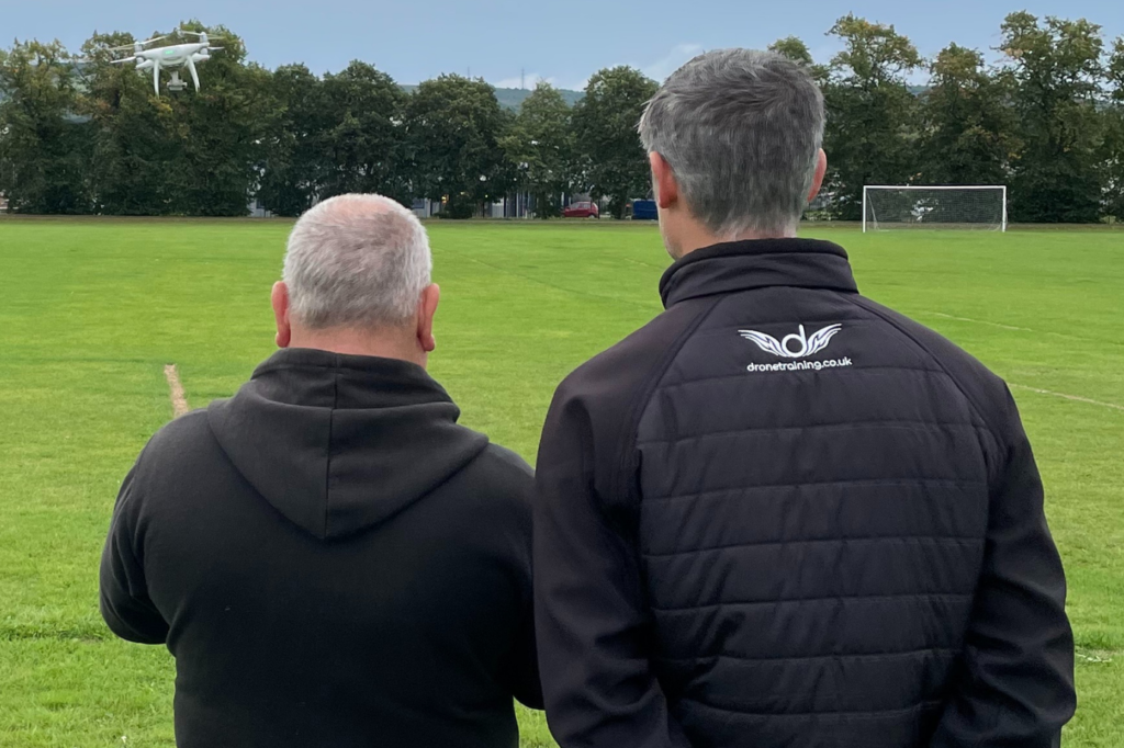
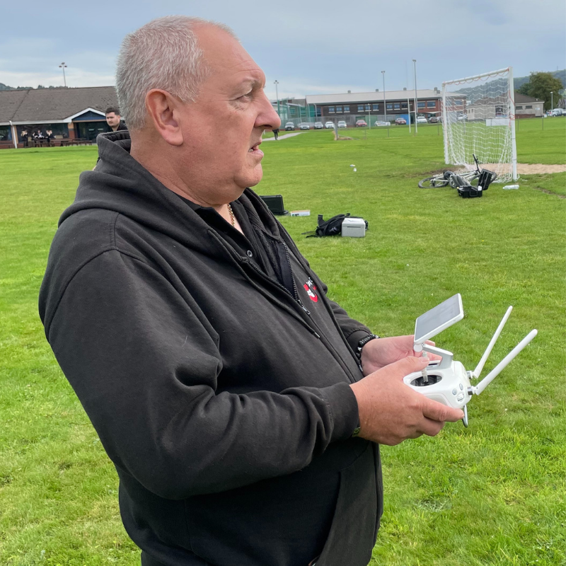
Global Drone Training delivered the week-long pilot programme at NPTC in south Wales, which was attended by staff from the college like Julian, as well as delegates from Sellafield and Network Rail. 

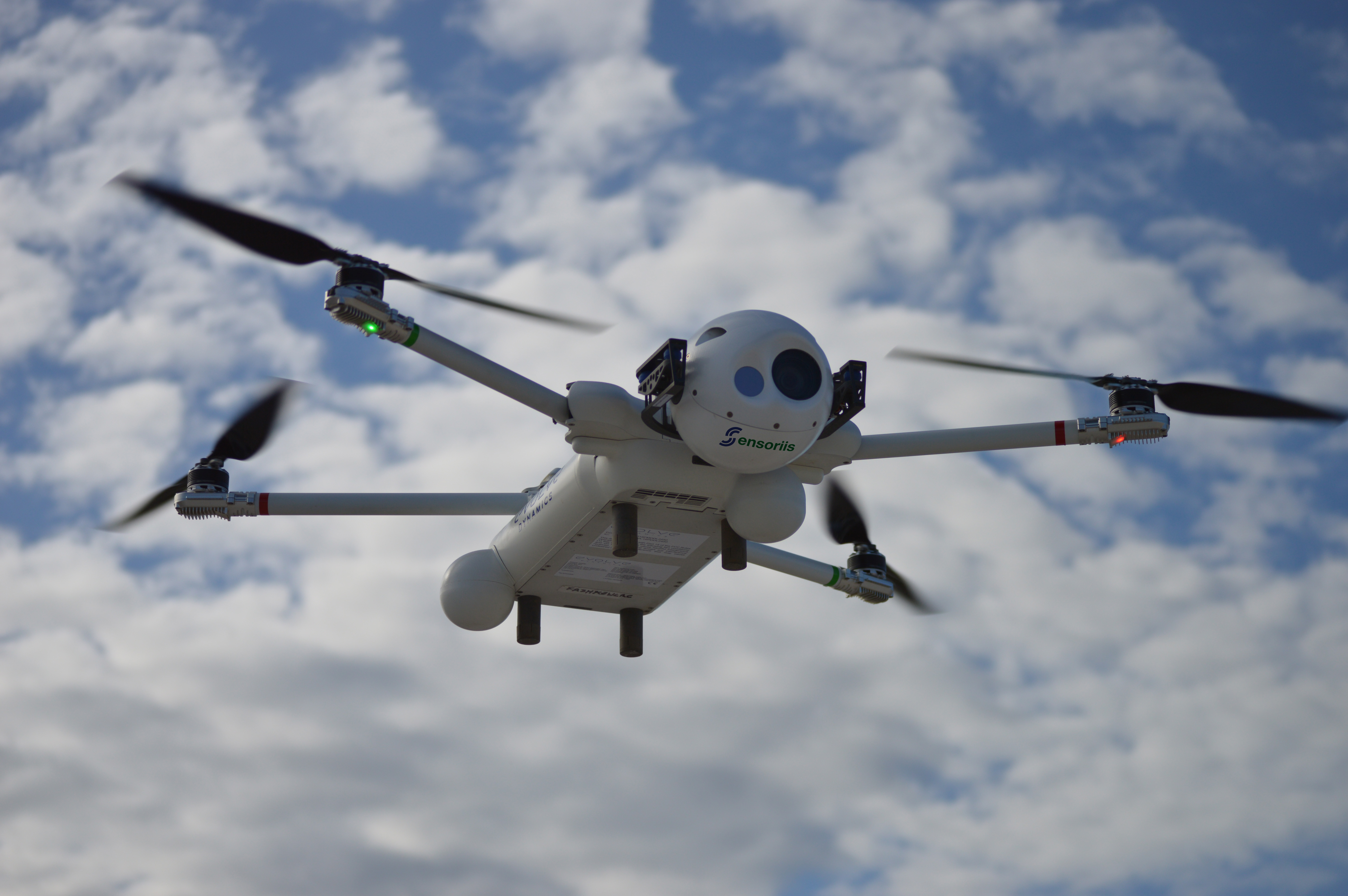
The course, which involves a mixture of classroom work and practical flying, includes how to comply with site policies and procedures, and is assessed by a practical flight competence test, where operatives pilot a drone in a real environment and capture, store and share viable images.

Julian, who passed the course alongside college technician Levi Harris, says the course is ideal in taking people up to a consistent foundation level for flying drones on industrial sites.

“I’m really grateful I was chosen to be one of the guinea pigs to sit the course,” said Julian, who instructs apprentices in mechanical engineering at the college.

“There was a lot of information, and it was intense at times, but the team at Global Drone Training were amazing and extremely knowledgeable. They made it an interesting, fun and enjoyable course and I absolutely loved it – to the point that I went out and bought my own drone!

“You learn about all the things you need to do or check, like pre-flight checking, the weather, the environment, where you can and can’t fly, and different types of drones. 

“For anyone daunted about doing it, I’m 60 years of age and the only drone flying I’d done before this was literally just around a field for 10 minutes, but this is something I was able to come to terms with as they don’t rush you. 

“I think everybody could do it, it’s just about showing the right commitment and attitude.”

Drone course ‘can make a real difference in industry’

The interest in using drones across industry is growing rapidly due to their flexibility, the safety benefits, increased efficiency for workers, cost savings and a reduction in asset downtime for inspections. Yet, until now, no consistent training existed for operators to use drones within an industrial setting.

The ECITB developed the training to provide a consistent quality standard for all industrial drone operators, with the course providing an understanding of drone functionality and how to conduct operations on industrial sites, safely, effectively and efficiently.

“This is a whole new way of looking at fault finding within the industry,” added Julian. “Workers can be a lot safer as they are not exposing themselves to risk by going into dangerous areas. 

“I would definitely say it’s a huge step forward in engineering skills. It’s the future as it’s so much safer, saves time and the footage you get back from the camera is incredible.”

Julian was invited on the course as he’d shown an interest, having previously built an underwater tethered drone as part of some of his work helping the college’s own drone academy.

NPTC Group of Colleges, which is one of the largest further education providers in Wales, was part of a working group to help get the ECITB foundation drone course off the ground.

Jayne Jones, Head of the Business Development Unit at the college, said: “The pilot course provided our learners with the skills needed to pilot drones in high-risk environments.

“This year has seen some significant growth for our Drone Academy. With the emerging and broad skills needs of industry – especially in relation to our Net Zero Academy – the College Group has been working with respected and trusted experts in the field of drone technology and skills to expand our offer. 

“This, in conjunction with the team at the ECITB, has seen ground-breaking drone course development that we believe can make a real difference in industry, not only with the advancement of skills in piloting drones, but in making practices safer, economical and sustainable.”

Find out more about the ECITB Foundation UAS Course here: Foundation Unmanned Aircraft Systems (UAS) Training Course – ECITB

SAM IS ....
Is your council ready for the growth of drones and air taxis?

AAM4Gov, the AAM Academy for UK City and Local Governments has launched the first on-line courses to support UK local authorities engage with the drone and advanced air mobility industries to save lives, improve delivery of council services and reduce carbon emissions whilst also ensuring communities are protected from illegal and inconsiderate use of drones.

Brighton, October 24, 2023 AAM4Gov, the AAM Academy for UK City and Local Governments, has announced the launch of the first courses on its learning platform focused on closing the skills gap among local authorities in developing new policies to optimise drone and future electric air taxi services, part of the new advanced air mobility (AAM) transport revolution.

AAM4Gov is supported by the UK Research and Innovation Future Flight Challenge, delivered by Innovate UK and the Economic and Social Research Council, having won funding from the “Future Flight: closing the skills gaps” competition.

“While many councils have been using drones for years to reduce survey and maintenance costs and support first responders – such as fire services, police and coast guard units – in saving lives, new technology developments are about to rapidly increase the number and capabilities of drones in the skies above us,” said Philip Butterworth- Hayes, editorial director of AAM4Gov. “The first electric air taxis will fly in Europe next year, while drones will soon be delivering defibrillators, medicines and pizzas to households throughout the UK. For councils, this is an opportunity and a challenge. Our remote learning courses have been designed to help local authorities more easily and quickly develop policies to optimise the benefits and reduce the risks.”

The first three courses now available are:

  1. An Introduction to AAM & UAM
  2. Community Benefits of Drones and eVTOLs
  3. AAM Public Consultation – covering methods of engaging with local communities to ensure citizens’
    needs are prioritised in any new service launch.

Further courses scheduled for November are:

  1. AAM Drone Security – critical aspects of drone security and managing drone nuisance
  2. AAM and the Law
  3. AAM Policy Making – developing drone/AAM policies which attract new investment and business, while reducing costs and environmental footprints.

Courses are designed to meet the needs of local authority senior decision makers and those involved in policy making, planning, first responders, estate management and surveying, transport, environment and social services.

Interested? Register at AAM4Gov.com and enrol to get full access to the initial courses which are available for free for a limited introductory period.

SAM IS ....
BT Launches UK’s First Drone SIM to Revolutionise UAV Connectivity

ARPAS-UK members BT, Sees.ai, Skylift and Skyfarer have collaborated to pioneer in telecommunications, unveiling the launch of the UK’s inaugural Drone SIM. This cutting-edge technology is set to unlock the full potential of beyond visual line of sight (BVLOS) drone operations throughout the United Kingdom.

The Drone SIM, designed to function seamlessly via the EE network, offers unlimited data plans and continuous connectivity while soaring through the skies. It boasts robust construction that can withstand vibration, extreme temperatures, and humidity, making it suitable for year-round drone usage. Initially, BT’s business customers will reap the benefits of this transformative technology, which has the potential to revolutionize a multitude of industries. From the swift delivery of medical supplies to infrastructure monitoring and efficient transportation of goods, the applications are boundless.

Leveraging the BT Group’s EE network, the Drone SIM enjoys high-priority, ultra-responsive connectivity. This ensures safety, precise control, telemetry, and the ability to stream ultra-high-definition (UHD) video content at altitude. This breakthrough empowers drone users to capture detailed, survey-grade imagery and videos, facilitating various applications, from search and rescue missions to infrastructure inspections.

oilseed rape, fields, drone-5263591.jpg

The Drone SIM represents a remarkable leap forward in drone flight capabilities. With the broadest geographic coverage in the UK, unmanned aerial vehicles (UAVs) can now travel significant distances, fully unleashing their capabilities, all while maintaining continuous communication with remote pilots and safety systems. This marks a profound departure from the previous limitations imposed by line-of-sight radio transmission or local Wi-Fi connectivity.

Etc., the digital start-up and incubation arm of the BT Group, has played a pivotal role in driving innovation in the drone industry. Their historic collaborations, including a £5 million deal with Altitude Angel to develop the UK’s first drone superhighway, exemplify their commitment to advancing drone technology. The launch of the Drone SIM follows a series of successful trials and developments by the Etc. team. These trials encompassed critical infrastructure inspections with drone technology provider sees.ai, the validation of BVLOS mission safety standards in integrated airspace with turnkey Uncrewed Aerial System providers Skylift, and even powered a groundbreaking drone medical delivery trial with aerial logistics specialist Skyfarer.

Dave Pankhurst, Director of Drones at BT, expressed his excitement, stating, “Following the successful trials of our Drone SIM over the past year, this announcement is a huge stepping stone in bringing drone connectivity to businesses across the UK, unlocking potential for more efficient processes, business transformation and, with the ability to power search and rescue missions and medical deliveries, helping to save lives.”

Eduardo Aldaz-Carroll, Chief Technology Officer at sees.ai, emphasized the significance of drone inspections for critical national energy infrastructure. He said, “Drones offer significant benefits by increasing the speed, efficiency, and consistency of data capture so we can predict the future state of the asset with reduced risk and environmental impact. It’s great to be working with BT Group to develop the technologies required to roll out BVLOS drone inspection and monitoring at scale.”

Nick Ruggles, Chief Technology Officer at Skylift, acknowledged the game-changing impact of BT’s Telecoms Grade C2 links, stating, “BT’s Telecoms Grade C2 links have halved our deployment setup times. With recurring costs at just 14% of other systems and virtually zero infrastructure expenses, this is a game changer for us.”

Georgia Hanrahan, Chief Operations Officer at Skyfarer, highlighted the efficiency gains, saying, “With the Drone SIM powering BVLOS flight, we can take a 20-minute flight between two hospitals and reduce this to a more direct 8-minute flight. Perfect for time-sensitive deliveries. We estimate a wider scale roll out nationwide could reduce our delivery time by 60% compared to road transport.”

The Drone SIM is now available for purchase via the BT website.

SAM IS ....
Evolve Dynamics and Cambridge Sensoriis Achieve Ground-breaking Fully Autonomous Drone Landing with ARC Radar Sensors

In a remarkable partnership, British UAV manufacturer Evolve Dynamics and radar technology specialist Cambridge Sensoriis have achieved a historic milestone in the world of autonomous drone technology. Together, they have successfully executed the world’s first fully autonomous drone landing, thanks to the integration of Cambridge Sensoriis’ ARC radar sensor devices with Evolve Dynamics’ Sky Mantis UAV. This groundbreaking achievement allows for autonomous landing, loitering, and zonal position holding, all without the reliance on other sensors, making it especially well-suited for GPS-denied environments.

Laurence Mallinson, Chief Commercial Officer at Evolve Dynamics, underlined the significance of this technological leap, stating, “Using radar pods that communicate with each other, our UAVs will be able to land autonomously in any weather, on a moving host platform, or in a GPS-denied environment. The key aspect of the system is that it is not reliant on visual navigation methods such as 2D barcodes or LEDs, and therefore is able to operate in adverse weather conditions and complete invisibility, such as fog or mist.”

The collaboration involves ground-based radar beacons from Cambridge Sensoriis establishing communication with an airside radar mounted within the Sky Mantis aircraft, providing precise positioning data to the autopilot.

This innovative technology empowers Evolve Dynamics’ Sky Mantis with robust positioning autonomy, enabling a wide range of operations, including vessel landing, loitering in both static and moving holding positions, and maintaining flight within defined corridors or zones. Thanks to Sensoriis’ radar capabilities, Sky Mantis can now launch from, follow, and land on moving vehicles or boats.

Steve Clark, CEO of Cambridge Sensoriis, expressed his excitement about the partnership, saying, “We’ve believed for some time that our radar-based positional information could add value to drone deployments, but it has taken the expertise and support of Evolve Dynamics to see that come to fruition with actual real-world autonomous maneuvering and landing. It’s a first for us. We’re delighted with the collaborative spirit of this partnership and the opportunity ahead.”

Mike Dewhirst, CEO of Evolve Dynamics, emphasized the importance of this achievement, saying, “This is a major step forward. To achieve resilient autonomy and positioning without existing infrastructure, such as GPS, is essential. This is critical in defense scenarios, where we already have a strong market presence, as well as for the general scalability of industry drone solutions that will require strong resilience and redundancy.”

This groundbreaking achievement marks a significant advancement in the field of autonomous drone technology and opens up exciting possibilities for various industries, including public safety, defense, and energy. Evolve Dynamics and Cambridge Sensoriis are committed to pushing the boundaries of UAV technology and contributing to a better future.

About Evolve Dynamics: Evolve Dynamics is a UK-based UAV/UAS design and manufacturing company that provides aircraft and software solutions to customers across industries, including public safety, defense, and energy. Their mission is to find solutions to real-world problems through UAV technology, focusing on user needs and contributing to a better future.

SAM IS ....
ICAO call for papers on AAM

The Global Advanced Air Mobility (AAM) Academic Paper Competition offers a platform for university students from around the world to showcase their groundbreaking ideas, research, and insights within the realm of AAM. This competition seeks to engage students in exploring various aspects of AAM, including, but not limited to, technology, safety, regulation, urban planning, legal considerations, and sustainability.

Competition theme: Advancing AAM solutions

Competition details:

  • Objective: The competition aims to stimulate innovative concepts for new AAM solutions and services.
  • Eligibility: Open to university students enrolled in a Master’s, or a PhD program. Students enrolled in the final year of a Bachelor’s degree may also participate.
  • Submission guidelines: See competition timeline below. 
  • Recognition: Winners will have the exclusive opportunity to present their work during the prestigious AAM 2024 event.
  • Distinguished jury: The discerning panel includes the following representatives:
    • Iryna Borschchova, Ph. D., Research Officer, National Research Council Canada (NRC)
    • Robin Garrity, Senior External Affairs Officer, Single European Sky ATM Research (SESAR)
    • Adriana Andreeva-Mori, Researcher in Aeronautics (Air Traffic Management, Operations), Japan Aerospace Exploration Agency (JAXA)
    • Dr. Kelley Hashemi, Airspace Operations and Safety Program Partnerships Lead, National Aeronautics and Space Administration (NASA)
    • Divya Bhadoria, Manager, AMP Airspace Operations, National Aeronautics and Space Administration (NASA)
    • Jim Murphy, AAM System Architect, National Aeronautics and Space Administration (NASA)
    • Michael Patterson, Ph. D., AAM Mission Integration Office Systems Analysis Lead, National Aeronautics and Space Administration (NASA)

Competition timeline:

  • Announcement of competition opening: 6 October 2023
  • Initial title/abstract/bio submission deadline: 30 November 2023
  • Notification of acceptance: 30 January 2024
  • Closure of paper submissions: 15 May 2024
  • Winner notification: by 30 June 2024

For more information

SAM IS ....
BVLOS Risk Quantification Workshops

We’re excited to announce our upcoming 2-day BVLOS risk quantification workshops, designed to support enabling BVLOS flights at a large scale in the UK. This exclusive opportunity will cover the intricacies of risk quantification in the context of SORA and beyond.

However, we can’t finalise the details without YOUR input. Please take a moment to fill out our survey to help us determine the best time and place for these workshops. As a token of our appreciation, all survey respondents will get early access to bookings. Remember, seats are limited and it’s a first-come-first-serve basis.

These workshops will be £500 for non-members and FREE for all ARPAS-UK members.

Each organisation can only send one attendee. For companies interested in group training, private bookings are available. For further details, please reach out to membership@arpas.uk.


SAM IS ....
Travelling through airports with your drone

Most airports, airfields and spaceports have a flight restriction zone (FRZ) that applies to drones and unmanned aircraft. 

drone, technology, a-3202860.jpg

In a recent drone podcast by the CAA, Tom Guest from the CAA RPAS team explains why these FRZs are in place and how they work. They also cover guidance for passengers who are travelling with a drone and what to be aware of when you’re at the airport. You’ll also hear from Gatwick Airport’s Stable Operations Lead, Aaron Bassett, who explains what happens when their systems detect a drone and the impact this can have on airport operations.

The podcast is available from the CAA Drone Safety series.

SAM IS ....
Delivering UAS BVLOS flight in non-segregated airspace using aviation-grade Command & Control: WATCH AGAIN

CPD overview:

Earlier this year, uAvionix, Skylift and and British Telecom successfully conducted demonstration flights using uAvionix’s SkyLine cloud-based command and control (C2) system communicating over C-Band and LTE.  The flights achieved two UK firsts for UAS operations; operational Command and Non-Payload Communications (CNPC) C2 systems using C-Band and LTE via BT’s Drone SIM and secondly the transmission of ADS-B OUT on 978 MHz for detect and avoid (DAA) operations. 

This demonstration was observed by the CAA. (https://uavionix.com/bt-group-drone-sim-and-uavionix-skyline-deliver-firsts-for-uk-uas-operations-with-skylift-demonstration-flights/)

The UK CAA participate in the ICAO RPAS Panel, which is working to deliver C-Band CNPC at an international level. 

uAvionix has gained US FAA and FCC approval to operate its SkyLink C-Band C2 radios for true BVLOS operations in non-segregated airspace. The radios operating on aviation-protected C-Band frequencies are controlled by uAvionix’s SkyLine cloud-based C2 network solution that combines fleet management, network health monitoring, detect & avoid, and seamless make-before-break roaming between multiple radio networks and ground stations. The system also uses other radio networks, such as LTE, for multi-path, multi-datalink assured CNPC C2.

C2 radio design assurance is critical to meeting the criteria needed to manage risk during BVLOS operations and to meet the safety case requirements. The C-Band C2 radios are compliant with RTCA DO-362A and will become aviation certified to TSO-C213a in due course. The SkyLine cloud-based network control and associated SkyLink and SkyStation radios are the first certifiable C2 network purpose built for BVLOS operations.

uAvionix, operating at the Choctaw Nation of Oklahoma (CNO) Emerging Aviation Technology Center, recently completed the first true Beyond Visual Line of Sight (BVLOS) flight in non-segregated airspace using aviation protected C-Band in the United States. Serving as the Command and Control Communications Service Provider (C2CSP), uAvionix completed the historic flights for CNO, FAA and industry leaders to demonstrate the effectiveness of combining C2 link management and situational awareness for Detect and Avoid (DAA) through the company’s SkyLine software service offering. The flight, a culmination of a multi-year effort involving engineering, operations teams and regulatory review, heralds a significant advancement for UAS operators and businesses seeking to commercialise scalable UAS operations such as medical and package delivery, linear utility inspection, and emergency management. (https://uavionix.com/uavionix-and-choctaw-nation-of-oklahoma-complete-first-us-flights-exercising-faa-and-fcc-approvals-for-aviation-protected-c-band-and-beyond-visual-line-of-sight-