A Brave New Dawn in the world of Engineering with the Advent of Drone Technology
Engineers aren’t known for taking risks lightly – what we do doesn’t really allow for error and taking a risk brings in too much scope for error. And if engineers are slightly cautious, engineer surveyors are even more so.
But being in a traditional, perhaps even cautious sector, doesn’t mean that we aren’t always looking for new ways to solve old problems. And increasingly, those new ways are tech-based. One of the most exciting applications of new technology I have encountered is drones.
Safety always has, and always will be, paramount when it comes to engineering – not just at the design and build stage but throughout the lifetime of the equipment. Which is why there are very firm and clear regulations around the inspection and upkeep of equipment such as cranes and other lifting equipment.
Periodic, thorough examinations of lifting equipment must be completed every six or twelve months unless a risk-based examination scheme is in place. But for most, this regular and necessary examination requirement can mean undertaking a lengthy and expensive process, usually involving MEWPs (Mobile Elevating Working Platform) or erecting scaffolding every single time.
Which is fine because it’s necessary, but I said, we are always looking for new ways to solve old problems and drones have shown themselves to have an important and cost-effective role to play in equipment examinations.
We have been exploring the potential role for drones for some time, but it is a conservative sector, so it took a while before a client willing to try them appeared. In 2016, that innovator presented themselves and asked us to explore the use of drones to examine their crane equipment.
Reducing Risk, Cost and Time
Their motivation was not only to save time and cost but to reduce the risk of working at height in completing the examination. So, sending a drone up to do the job seemed like the best option. And it was – the client was able to have the examination completed within hours rather than days and at a fraction of the cost. The future for drones in engineering examinations had just been opened up.
But before engineers run towards drones en masse to solve their examination problems, there are limitations to what drones can do. A thorough examination requires all our senses of which drones can only (currently) replicate one – vision. But even having that one sense digitised can bring huge benefits.
One recent example is where I had to examine a number of runway tracks and overhead cranes for a company – trouble was, they were incredibly awkward to access.
Traditional Access Methods
We looked at other options such as a cherry picker but even that wouldn’t provide the necessary access and the hope was that we could avoid the cost and delay of bringing in scaffolding. Thankfully, during the initial accessed examination, nuts and bolts were marked with contrasting paint to help identify any movement in the structure. Something that a drone-mounted camera could monitor with ease and impressive precision.
The realisation that the drone could help manage this aspect of the examination, led us to investigate how they could reduce the need for annual, hands-on examinations. In the end, were able to develop an examination scheme that used drones on an annual basis to check for movement with the full, accessed examination taking place every three years.
Significant Savings
The savings made by removing the cost of scaffolding in two out of every three years is significant. And if no deterioration is noted during the three-year cycle, we believe we can extend the period between accessed examinations and all the cost that entails, to five years.
That is significant whichever metric you are using to measure effectiveness, but it is only scratching the surface of how drones can assist examinations. And while the applications may be somewhat limited today, I have every confidence that drones will play an increasingly significant role in engineering examinations as the tech develops and as engineers see just what they are capable of.
Andy Kidd is Chief Engineer at British Engineering Services
Iprosurv seeks to bring greater professionalism to the drone sector with launch of new network proposition
Iprosurv, one of the UK’s leading commercial drone providers, has today launched Pilot Partnerships, an ambitious new proposition to bring together the nation’s independent operators and drive greater levels of professionalism across the sector.
Billed as a co-operative for commercial drone pilots, Pilot Partnerships aims to bring together the huge number of independent operators to provide mutual support, share best practice and work together to drive greater levels of professionalism and public trust in the sector.
Using Iprosurv’s proprietary software platform, members of Pilot Partnerships will have access to case management and flight planning software, data security, safety and environmental compliance support, tailored training, bespoke websites and a host of marketing and client prospecting support.
Commenting on the new initiative, Rebecca Jones, CEO and co-founder of Iprosurv, said: “The commercial drone industry is growing fast as more and more businesses look to new technology to solve old problems.
“But the commercial drone market is fragmented and made up of sole traders and micro-SMEs and the introduction of new regulations has made life tough for many. If we are to become the mature, professional industry that more and more sectors expect us to be, we have to come together, work together and grow together to create that.”
Iprosurv has a well-established network of drone pilots and has made a significant investment in ensuring that Iprosurv and its partners have the latest, safest technology available to help establish drones as a permanent feature of doing business.
“We have huge ambitions for our sector, but we know we can’t do it on our own and we don’t think the hundreds of independent, professional operators we want to work with across the country can do it on their own either,” said Jones.
“Which is why we have set up Pilot Partnerships. We hope that, in time and with the right partners, Pilot Partnerships will become the gold standard in the industry and a guarantee of quality and professionalism to clients of all shapes and sizes.”
Pilot Partnerships is the first mutually supportive, network proposition in the commercial drone sector in the UK. The target profile for potential members is sole operators and organisations that have a specific sector or technical expertise.
“As Iprosurv, we have made great inroads into our chosen sectors but as our profile has grown, the huge potential in other markets is becoming apparent and we want to bring all our compliance, operational and customer service expertise to as many sectors as possible,” said Jones.
“We are looking to partner with drone operators who have technical and operational experience but require the support of a larger organisation to exploit the opportunities they see or sector experts who can help introduce us, and our partners, to new markets.
“Together, we can make a mark on the economy and ensure that drones have an integral role to play.”
Entry into the Pilot Partnerships community requires a small one-off fee and small percentage share of fees.
Adjuster’s Perspective: How one Drone Flight saved an Insurer over £200k
2nd Feb
When it comes to using tech in insurance, it can be difficult to separate the wheat from the chaff. So many claims are made about how technology will enable adjusters to be more efficient and effective but with so much noise in the insurtech space and, regrettably, a number of false dawns, it can be difficult to know who or what to trust.
But taking a conservative, defensive posture in the face of digital progress simply isn’t an option – that is a sure-fire way to get left behind. Which is why at Crawford we carefully analyse, select and trial the range of tools we believe will make a real, practical difference.
This has always been our approach to restoring and enhancing rural lives, businesses and communities and one of the most effective tools we have adopted over the last couple of years is drones.
Think outside the box:
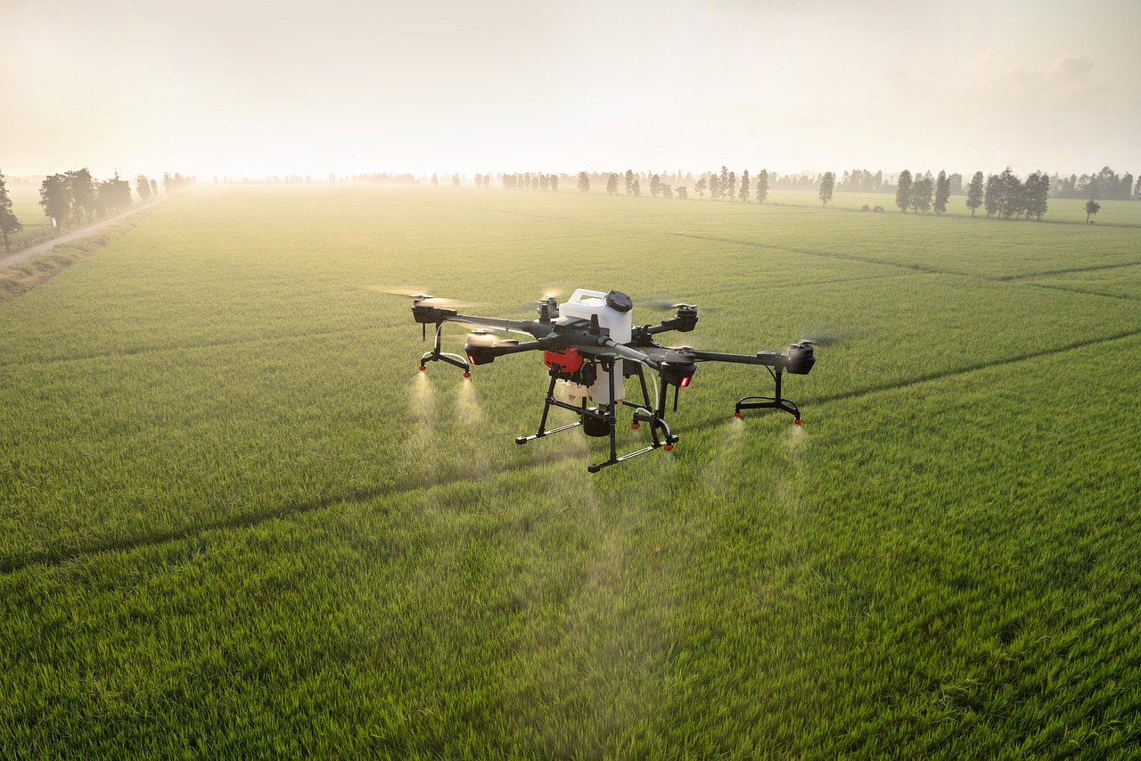
There is an assumption that they are best utilised in flood situations or major loss property claims – basically enabling quick and safe access to areas that humans can’t easily reach. And while that is correct, the applications of drone surveys also go far beyond providing access, as we have found. We started out using drones for flood and property damage claims but recently, we have been using them for core agricultural claims and with impressive results.
For instance, we were recently instructed on an agricultural claim that arose from hailstorm damage to an oil seed rape crop. Just before harvest, the crop was hit by a storm and the hail severely damaged the fragile pods that contain the rapeseed on a large portion of the open fields.
Traditional Approach:
The traditional approach would have been to get the wellies on and measure the perimeters and walk through the entirety of each affected field in a ‘W’ fashion to cover as much of the crop as possible, assessing the severity of damage. Our findings would then be reviewed in conjunction with the combine harvester readouts to try to obtain an estimate of the loss.
Back in 2018, we had discussions with Iprosurv about hailstorm damage to oil seed rape crops and whether drone inspections could assist, and two years later, with this instruction, the perfect claim arose for a trial.
Timing:
It was fortuitous timing as Iprosurv had recently added new equipment to their drones, namely Normalised Difference Vegetation Index (NDVI) cameras. In simple terms, these cameras analyse the different light colour spectrums reflected by the chlorophyll within crop vegetation – healthy plants reflect at a different light frequency to damaged or unhealthy plants.
Open Field Claims:
We are the first adjuster in the UK to use NDVI technology on open field claims, so it was a bit of an educated leap into the unknown, but the tech not only gave us a quick and accurate measurement of the damaged crop but also the overall health and expected yield of the standing crop. This allowed us to compare the expected yield with the yield achieved and indeed the ‘expected’ yield claimed by the Insured.
Enhanced Data:
That is a level of detail we have never been able to achieve before and, for an outlay of around £2,000 for the drone survey, footage and imagery, the insurer was able to make a £220,000 saving on the initial amount claimed. While that was something of a difficult conversation with the policyholder, the rationale for the settlement offered was all there in the data. As they say, the data doesn’t lie.
Despite what anyone might think, the main motivation for any insurer in any claim is to get to a settlement that is accurate and fair – using a drone fitted with an NDVI camera allowed us to do that with pinpoint accuracy in a relatively short timeframe.
Success:
Such was the success of this, we have started exploring other uses for drone inspections and we believe that it could be of huge benefit in environmental damage, aquaculture, spray drift and forestry claims. We could even use it to analyse the health of a potato crop without having to go through the disruptive, time consuming process of digging up the field. The possibilities are almost endless.
Exciting Times:
It’s an exciting time in the world of claims with more and more digital tools playing an increasingly important role. Whilst it’s true that tech isn’t the answer to all our questions, working with the right partners and with the willingness to try new things, we’ve found that you can effectively separate the wheat from the chaff, both figuratively and literally.
Iprosurv secures Extended Visual line of sight permissions from the CAA
Iprosurv, the UK’s leading drone survey, inspection and mapping provider and ARPAS-UK Member, has secured Extended Visual Line of Sight permissions from the Civil Aviation Authority for its network of remote pilots.
Standard aviation regulations insist that drones remain within the pilot’s sight at all times during flight which has historically limited flight distances to around 500m.
However, Iprosurv’s new permissions allow its remote pilots to fly drones up to 2km from the launch site, with no direct line of sight required by the remote pilot.
The special permissions, issued by the CAA have so far been granted to less than 1% of the nation’s commercial drone operators, means that Iprosurv pilots can not only fly closer to the target site but can also fly further and for longer periods of time providing clients with a complete and instant overview of an area or building.
This is not the first time that Iprosurv has received exemptions to current flight restrictions having secured reduced site control distances in 2018.
“We are delighted that the CAA has once again recognised the high level of training, safety and monitoring that takes place across our network of remote pilots and has seen fit to provide us with these new permissions,” said Iprosurv co-founder and CEO, Rebecca Jones.
“What may seem like a technicality is actually a huge leap forward in the capabilities of drones, particularly in the early assessment of disaster areas, assisting the emergency services and in the survey of inaccessible buildings.
“These exemptions will allow us to stream footage and data direct to the client’s desktop even before a site has been physically visited.”
Currently, when faced with a large survey area, pilots often have to stop a flight once the limits of line of site have been reached, drive to the next launch site and start the process again. Iprosurv’s new level of functionality will allow insurers, property managers and the emergency services to view the entire area and assess and triage the situation in real time.
“Drones have always had the potential to completely change the way we respond to disasters or large-scale surveys but having the ability to remain in the air for longer, going further distances and relaying real time data back to the client is a huge step forward,” said Jones.
“In granting these permissions, the CAA has shown a welcome willingness to help unlock the commercial and societal benefits of drones and we look forward to introducing our new capabilities to all of our clients.”
Iprosurv currently has a core of pilots trained and ready to use the new permissions and will have the full network trained by Q4 this year.


 2nd Feb