UAV LiDAR Scanning –with Clogworks Technologies and RIEGL Ultimate LiDAR™ – Watch Again
In this CPD session, join James & Jonathan as they explain the fundamentals of performing a professional unmanned aerial LiDAR survey.
We will explore Clogworks levels of performance & redundancy and how they affect operations, how to integrate a LiDAR system and highlight how you can ensure you have a “future-proof” platform.
Furthermore, we will cover the fundamentals of performing a professional unmanned aerial LiDAR survey. This includes highlighting the key components of a LiDAR system, the considerations around its selection, survey planning, and finally the main processing functions to produce a robust and reliable point cloud.
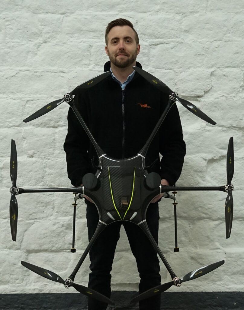
James Pearce, Clogworks Technologies Ltd, Sales & Marketing Officer
Since March 2022, James actively works with both new and existing customers to ensure Clogworks deliver the perfect aerial solution. Before that, he worked in Germany with a drone reseller and also used to have his own drone operator business. James draws on his knowledge of different UAV and LiDAR platforms to highlight different advantages.
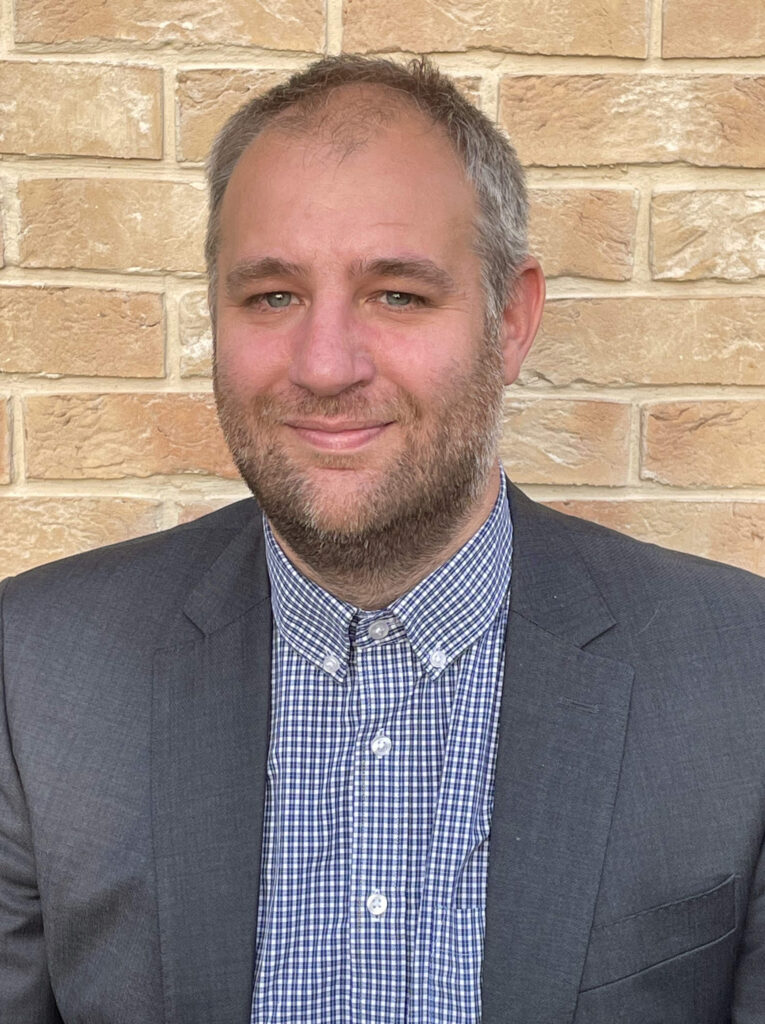
Jonathan Robinson, RIEGL UK Ltd, Product Sector Manager
Jonathan Robinson is a product sector manager at RIEGL UK Ltd with 23 years’ experience in the geospatial industry. He has enjoyed international roles both as a geomatics professional and within the design and manufacture environment, helping customers understand and use the latest geo-survey technology. Specialising in multi-platform dynamic laser scanning for mass-point acquisition, Jonathan uses his experience to demonstrate the capabilities of RIEGL Ultimate LiDAR TM on unmanned drones, aircraft, land vehicle and marine vessel.
SAM IS ....
CPD: Aerial data capture including deployment of LiDAR
by ARPAS-UK, in conjunction with Connected Places Catapult
Learn about the practicalities of drone operations and how sensor-based drones can provide benefits to your project
Surveyors, engineers and built environment professionals are faced with a growing portfolio of advanced technology, including drone-enabled sensors. In this online CPD learning session, Michael May, Operation Director at Flythru, will provide an overview of current legislation and what is required in order to bring drones to a project. Michael will also discuss how working practices can be adapted to make it easier to use drones on site, what the challenges and opportunities are for drone-use.
Key Learnings
Learn what a drone can and cannot do
Understand how data requirements match platform and operator
About the Speaker
An experienced entrepreneur and qualified pilot, Michael May is a director of Flythru, a company offering 3D mapping, thermal imagery and lidar; providing aerial data in a cost effective and safe fashion.
Professional development series brought to industry by ARPAS-UK, the drone industry trade association and Connected Places Catapult, who provide impartial ‘innovation as a service’ for public bodies, businesses, and infrastructure providers.
SAM IS ....
Routescene UAV LiDAR system used to reconstruct WWII concentration camp
The island of Alderney, a British crown dependency located 10 miles off the coast of France, was once home to a German SS concentration camp. Professor of Conflict Archaeology and Genocide Investigation at Staffordshire University in the UK, Caroline Sturdy Colls travelled with her team to the island to investigate the camp.
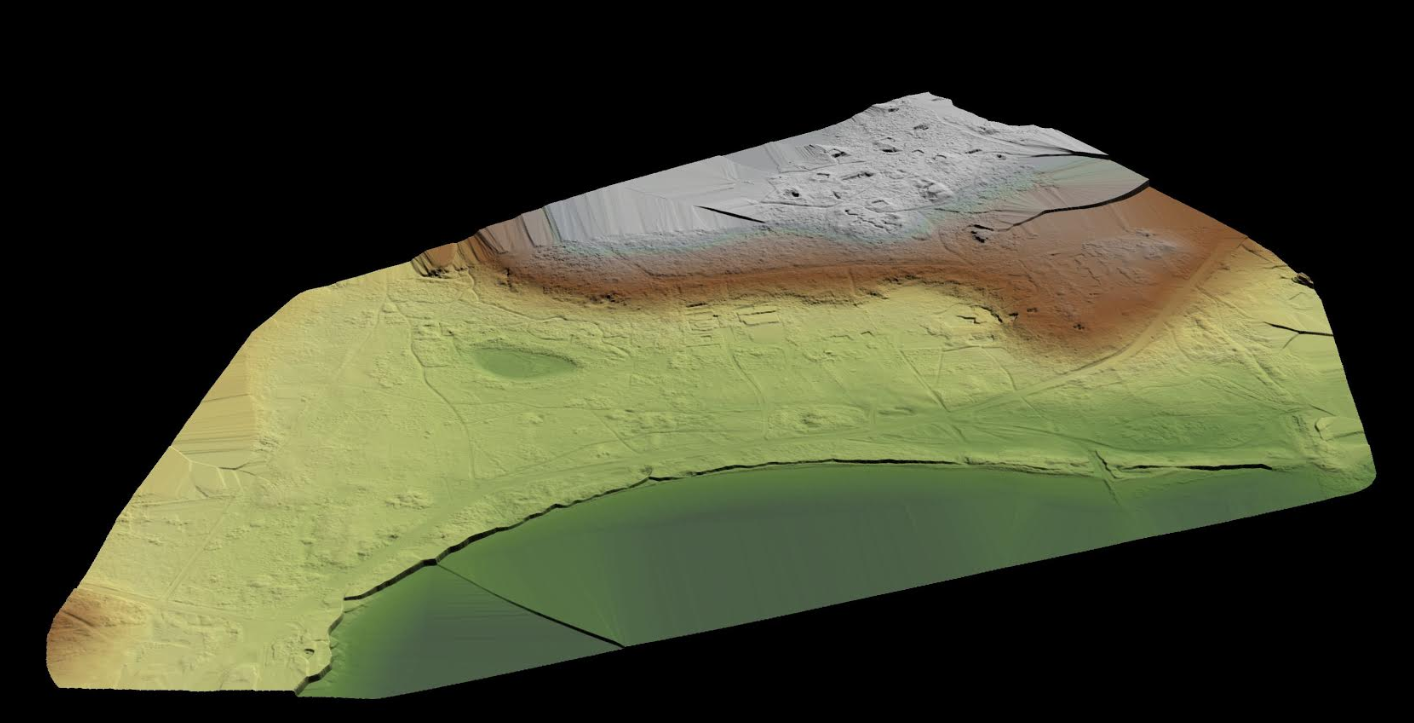
Lidar image of the the site with the vegetation removed
The investigation and the surprising results were the subject of a documentary ‘Adolf Island’ produced by the Smithsonian Channel. The documentary showcased Routescene’s 3D mapping technology and demonstrated how LiDAR is currently being used in industries such as archaeology, forensics and heritage to create a bare earth model to identify structures without disturbing or obstructing protected land.
Routescene’s technology uncovers full extent of gravesite
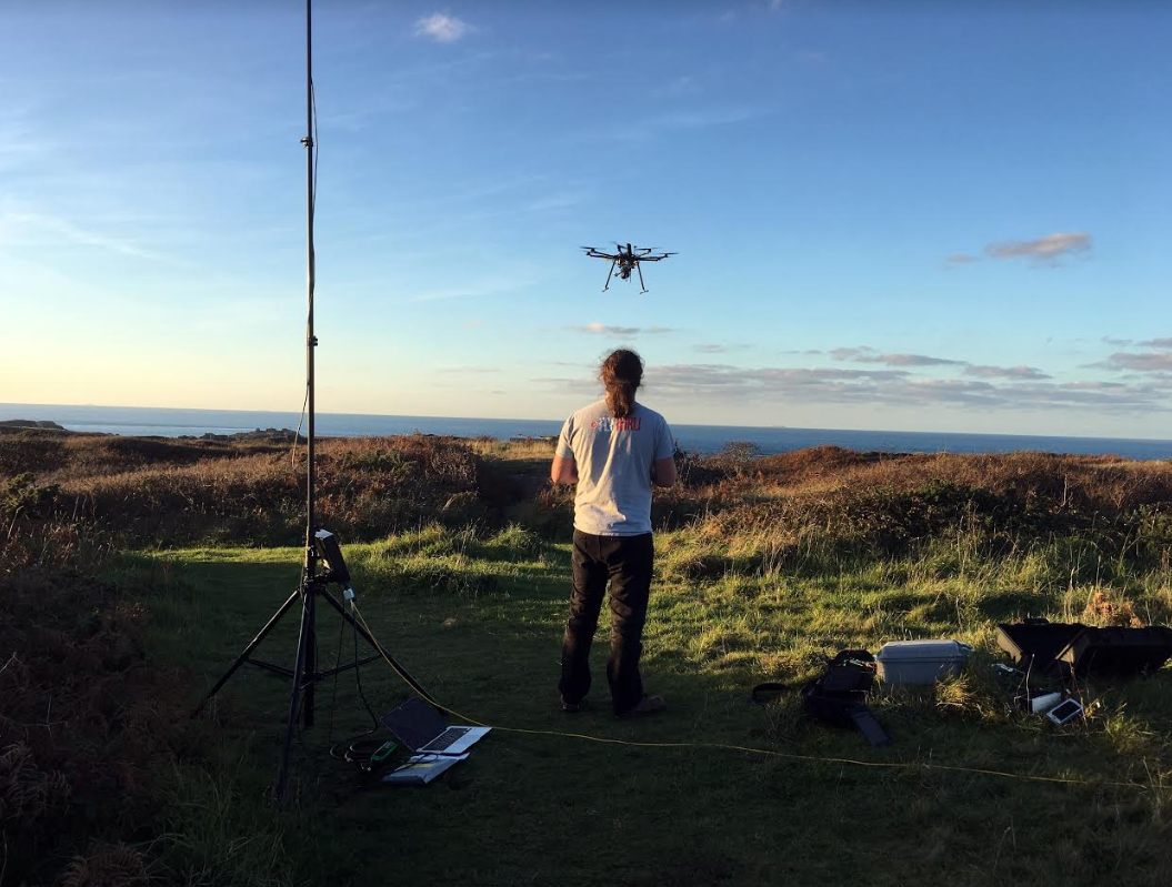
Routescene customer, and frequent collaborator, Flythru, was contacted by Professor Sturdy Colls to conduct a UAV LiDAR survey of the sites at Alderney. Sylt, the concentration camp built and run by the SS, and Longy Common, a graveyard, were chosen based on records from a German War Graves Commission investigation from 1960.
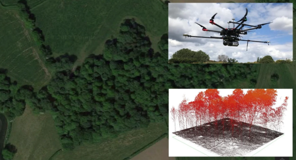
Flythru used Routescene’s integrated UAV LiDAR system. LiDAR is a remote sensing technology which measures the height of the ground surface and other landscape features using laser pulses. Designed for use on drones, Routescene’s LidarPod comprises a carefully selected array of sensors including the Velodyne HDL32 LiDAR scanner. With a scan rate of up to 1.4 million points per second from 32 different lasers angled in a 40-degree field of view, this sensor enables high resolution vegetation penetration. This helps users uncover ground features which are not easily visible from the ground or are obstructed by thick vegetation.
The Routescene LidarPod
Michael May from Flythru commented, “We have been using the Routescene UAV LiDAR system, which includes the LidarPod and LidarViewer, for over 3 years now. For applications where we need to penetrate vegetation it has proved to be a valuable tool. The number of laser hits we achieve on the ground is unparalleled with up to 400pts/m2 through thick vegetation. This equipment is ideal to survey sites which are overgrown or woods and forests which are inaccessible using conventional survey methods. Without UAV LiDAR it would have taken weeks to survey the Alderney sites. Due to the thick cover of vegetation it would not have been possible to visually detected the structures we found. With Routescene’s system on the UAV we achieved these results in a couple of 15 minute flights.”
Speedy data processing
The data gathered was processed on-site immediately after the UAV survey using LidarViewer, Routescene’s 3D processing and visualisation software. Using the Bare Earth Tool within LidarViewer the team quickly and easily removed all the non-ground points to reveal the surface below and produce a Digital Terrain Model (DTM). The DTM exposed previously undiscovered features that had been completely obscured by the vegetation covering the site. The Bare Earth Tool is newly available in the Routescene LidarViewer software package. Designed specifically for heritage applications like this, it considerably reduces the amount of time it takes to digitally remove all features above ground level. This allows artefacts covered by vegetation to be revealed in the DTM.
Michael added, “When you are on-site you need to visually present results as quickly as possible to establish if you have captured the results you need. We had limited time on-site on this project and needed to quickly assess the findings. The data processing with LidarViewer is so quick and easy you can present data within minutes.”
The terrain was covered in thick vegetation
Routescene founder and CEO Gert Riemersma commented, “We are proud the Routescene system is being used for such historically and socially important work. The system has proven to be ideal due to its’ portability and ease of use on such difficult sites. Combined with its’ high level of accuracy, ability to penetrate vegetation and process the data on-site is a real advantage.”
Utilising different survey techniques
In addition to using UAV LiDAR Professor Caroline Sturdy Colls also used photogrammetry, a different remote sensing technique in which hundreds (sometimes thousands) of photographs are taken of a site and stitched together to create an overall three-dimensional model.
Ground Penetrating Radar (GPR), which sends radio waves into the ground and allows artefacts under the ground to be detected, was also used. Overlaying all the results from the three different techniques provided an accurate, highly detailed 3D digital model of the camp, highlighting features of interest both above and below ground for further investigation.
Professor Sturdy Colls said, “The LiDAR and photogrammetry UAV surveys that Flythru completed on Alderney assisted us greatly in our research. The overgrown vegetation and the size of the sites that we were investigating made ground based surveys difficult and using UAV was the obvious choice. Flythru were knowledgeable, competent and friendly and explained every step in the process. Health and safety and securing permissions were at the forefront of their approach. The results were better than we could have hoped for. At SS concentration Camp Sylt many additional structural elements were identified in the LiDAR survey that were previously hidden behind dense vegetation. This allowed us to complete, for the first time, a digital reconstruction of this important site“.
For more information about the Routescene UAV LiDAR system including the software and new Bare Earth tool, please visit www.routescene.com